A significant outbreak of severe thunderstorms affected parts of Spain and France on Monday, bringing torrential rain, large hail, damaging winds and even a destructive tornado.
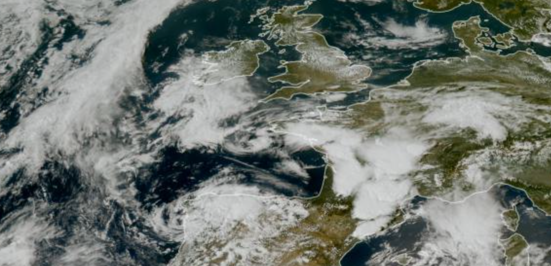
The unsettled weather was associated with an Atlantic low positioned close to Portugal. Warm and humid air already in place across Spain and southern France provided plenty of energy for thunderstorms as cooler air and stronger winds aloft approached from the west.
Severe storms across Spain
Spain was first to experience the widespread instability, with thunderstorms developing across several parts of the country before becoming particularly intense across the northeast.
Catalonia and Aragón were amongst the areas worst affected. Tarragona experienced torrential rain and hail, resulting in local flooding, numerous incidents attended by emergency services and disruption to the Rodalies rail network.
Further north, intense thunderstorms developed across Aragón and the Pyrenees. Hail was reported around Benasque, Campo and Montmesa, while rainfall totals included 29.4mm at Aínsa and 25.4mm at Formigal. Particularly notable was a wind gust of 109km/h (68mph) at Cerler.
The storms occurred as an area of low pressure moved close to the Iberian Peninsula, providing the lift and wind shear necessary for organised thunderstorms. AEMET had warned of strong or very strong thunderstorms capable of producing large hail and powerful wind gusts across northeastern Spain and the Balearics.
Destructive storms erupt across southern France
As the instability spread into France, thunderstorms became particularly severe across a broad swathe of the southern half of the country.
Météo-France described several separate waves of thunderstorms developing during Monday, including an organised system developing over southwestern France before rapidly progressing eastwards towards southeastern France. Storms also developed around Roussillon and Languedoc before further thunderstorms reached the Mediterranean coast during the evening.
Some of these storms produced exceptional rainfall rates. Météo-France had highlighted the potential for 30–50mm of rain within an hour, together with hail and wind gusts generally between 90 and 110km/h, locally approaching 120km/h (75mph).
Tornado strikes southern France
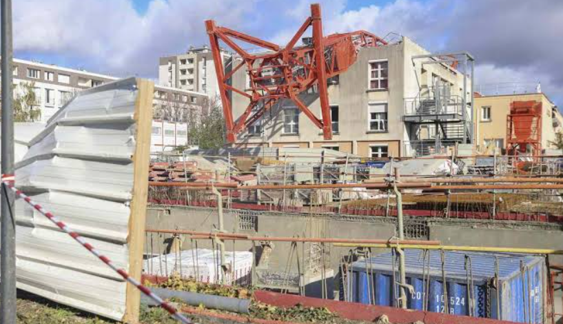
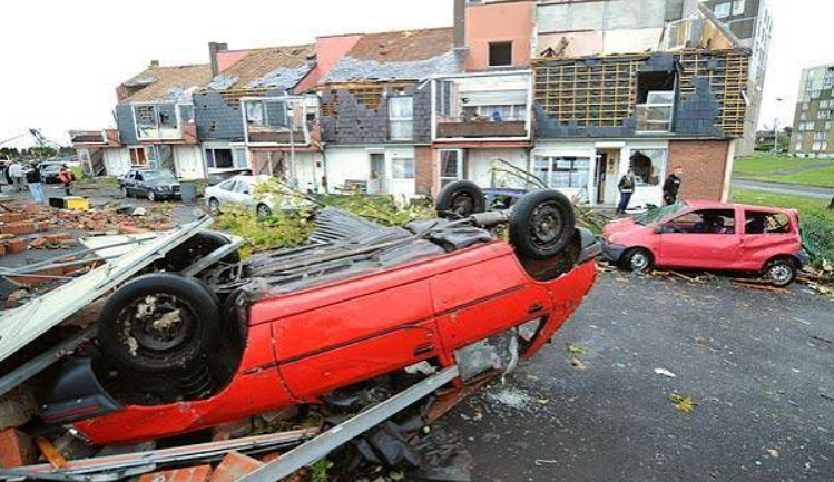
The most serious event occurred in the Aude department, south of Carcassonne, where a powerful tornado struck the village of Pomas during the late afternoon.
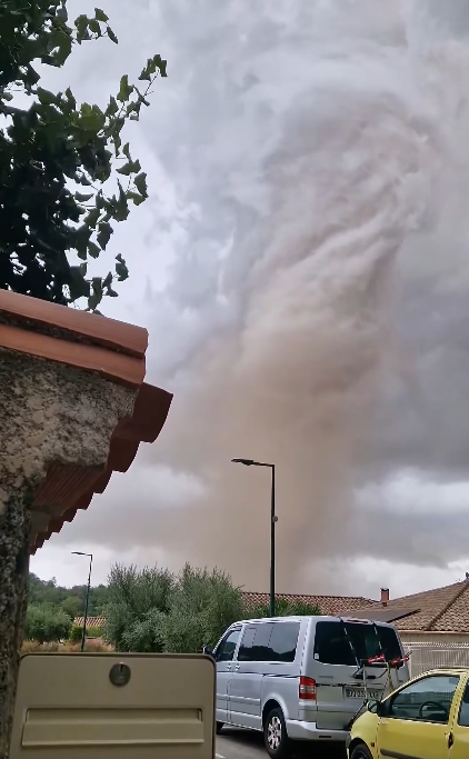
Around 300 homes were damaged and dozens of people were injured. Reuters reported 39 injuries, while subsequent French reporting put the figure at 41, with several people requiring hospital treatment.
The tornado occurred amongst an exceptionally violent cluster of thunderstorms across Aude. Hailstones around 3–5cm in diameter were reported, while wind gusts reached 117km/h at Arquettes-en-Val and 105km/h at Lézignan-Corbières.

Rainfall was also extremely intense, with 35.1mm falling in just one hour at Montolieu, while 29.1mm was recorded at Caunes-Minervois and 20.7mm at Carcassonne.
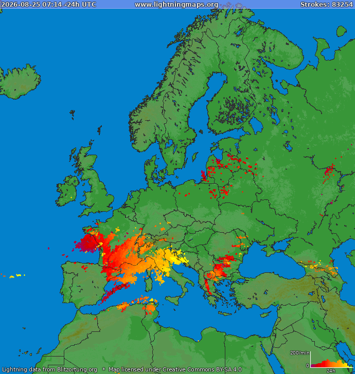
Lightning activity gives another indication of just how active the atmosphere became. Nearly 19,638 lightning strikes were recorded across France during Monday, making it the country’s second most electrically active day of the summer so far, according to figures reported from Météorage.
A dramatic breakdown after the heat
The storms marked a dramatic change following very hot conditions across parts of France and Spain.
The combination of heat and moisture near the surface, an approaching Atlantic low and increasingly favourable winds higher in the atmosphere created an environment capable of supporting strongly organised thunderstorms. Once storms developed, the available instability allowed some cells to rapidly intensify, producing large hail, destructive wind gusts and extremely high rainfall rates.
Radar imagery from Monday shows just how quickly individual storms developed and organised as the outbreak progressed from Spain into southern France.
The tornado in Aude demonstrates that European summer thunderstorms can occasionally become genuinely severe when instability and wind shear overlap sufficiently.
And the unsettled pattern isn’t necessarily finished. Further episodes of thunderstorms are expected across France during the remainder of the week as Atlantic low pressure continues to interact with warm and humid air over western Europe.