Firstly apologies for the lack of updates yesterday, I was struck down with the old covid virus. Not pleasant at all and still not 100% but the weather waits for nobody. With true irony trust the weather to be so active as well.
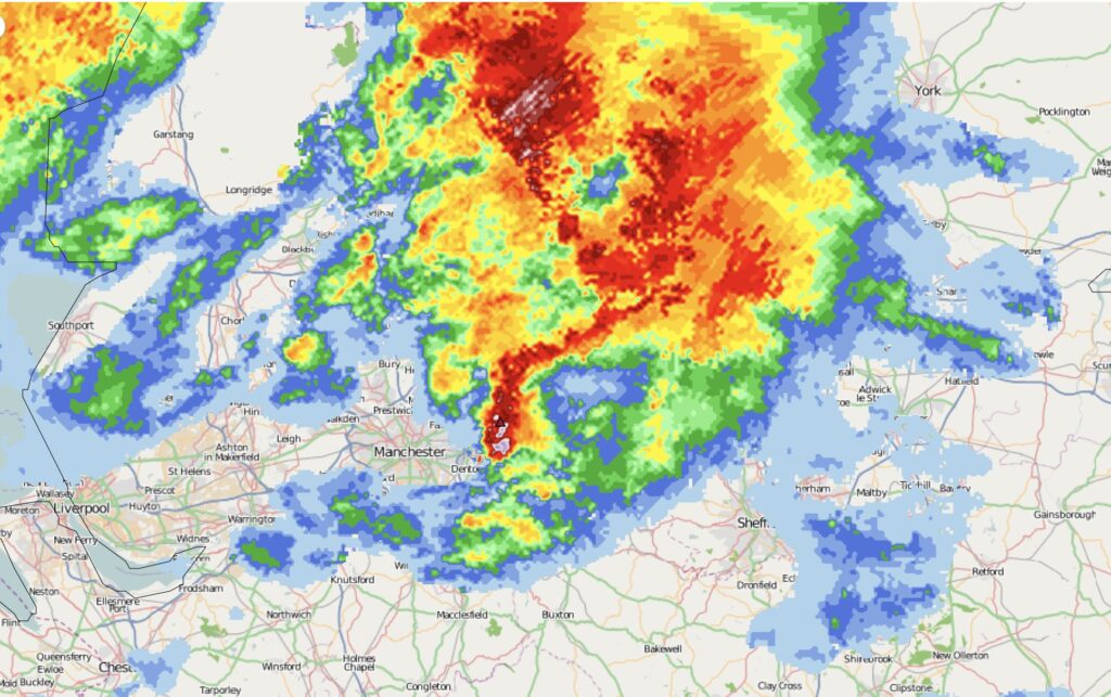
A line segment built in the Irish sea close to NW Wales in line with an upper trough but this started to show a bowing feature, which means very strong winds developing within the system and quickly became a small scale mesoscale convective system. The lightning data confirms this with may strikes recorded.
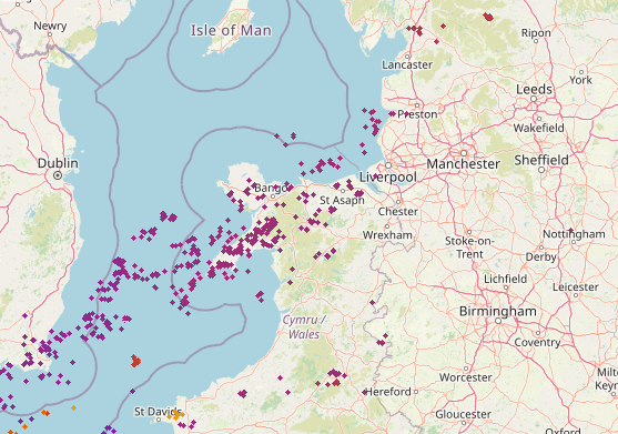
These little features are not uncommon for the time of year so don’t let the climate pushers tell you otherwise. Granted we normally see thunder and lightning in summer, this when warm surface temperatures shunt warm air into cooler air aloft but in winter the the same can occur with the air just above the sea being warmed sufficiently to cause instability with colder air just aloft. Furthermore there will be ample moisture in the developing system to further fuel the development.
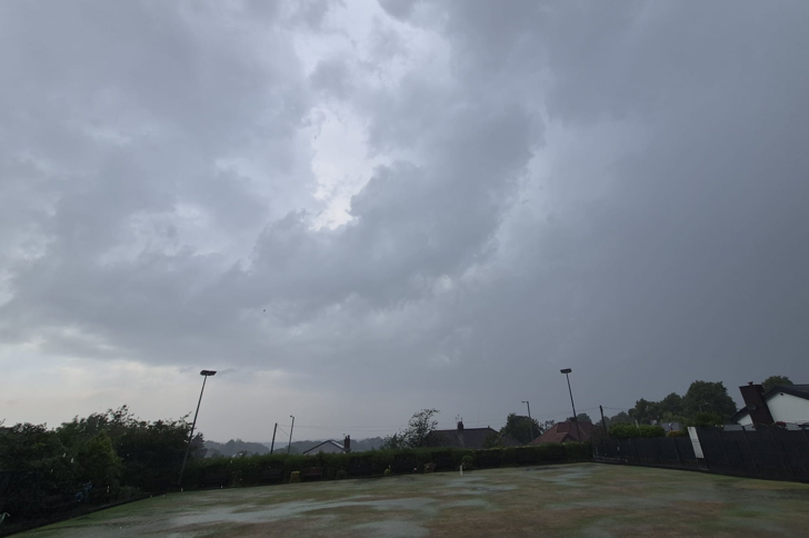
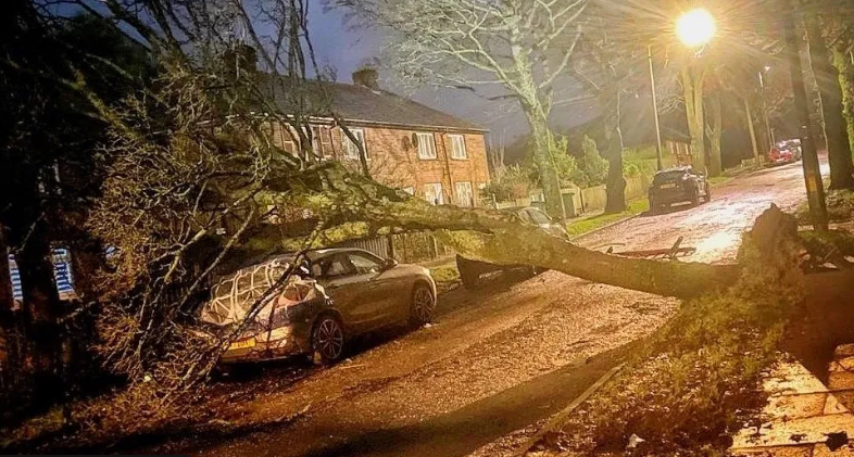
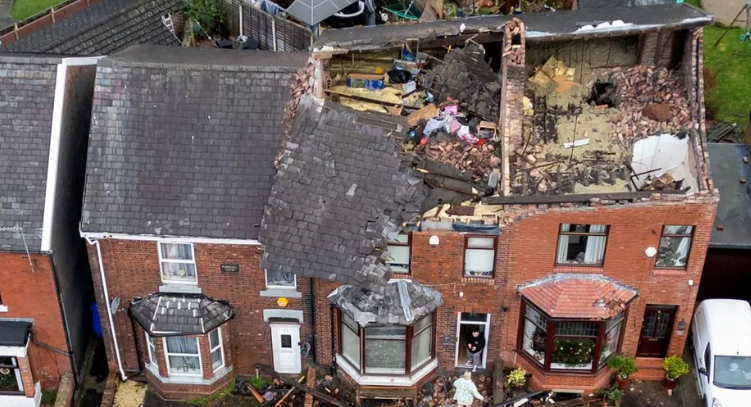
As the complex system passed through the North West we started to see the southern most flank starting to rotate in and around Manchester area before shifting N/NE. Areas from Greater Manchester to Stalybridge seemed to take the hit looking at news reports this morning, with structural damage reported on over 100 hours.

Where I have circled the feature on the radar image below, we can see where the rotation is and the clear slot in front showing the winds ahead being a SW’ly but locally in behind being more NW’ly.
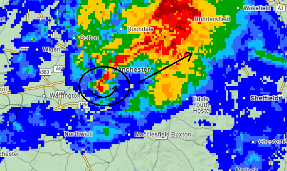
A more smoothed version of the radar image clearly show the intense signature where the likely tornado developed and travelled.