⚡ North West England Convective Outlook – Tuesday 30 June
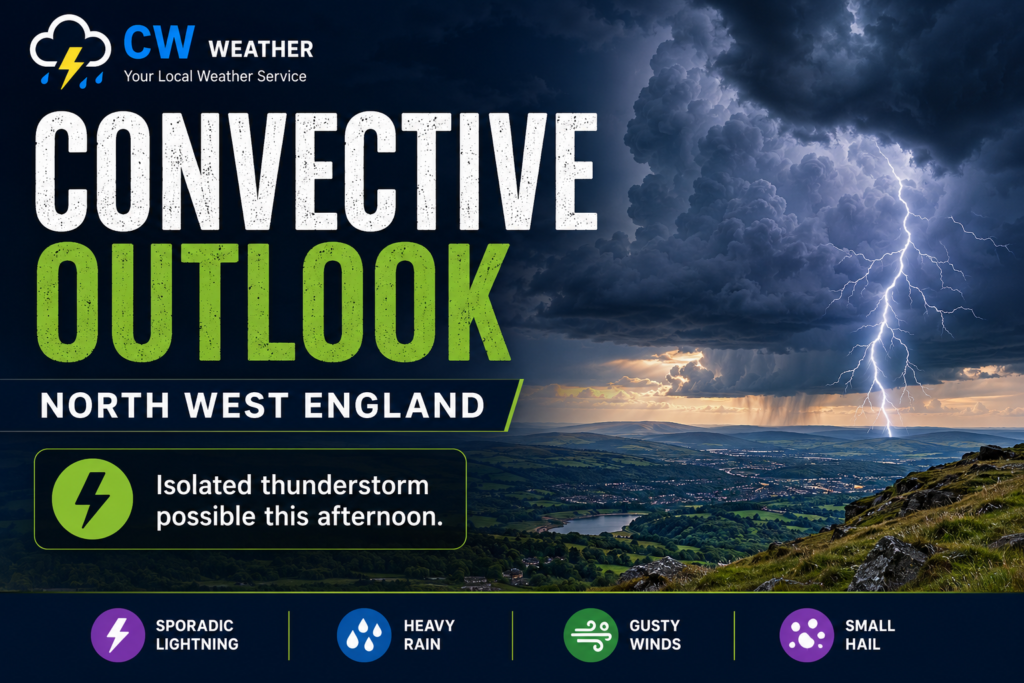
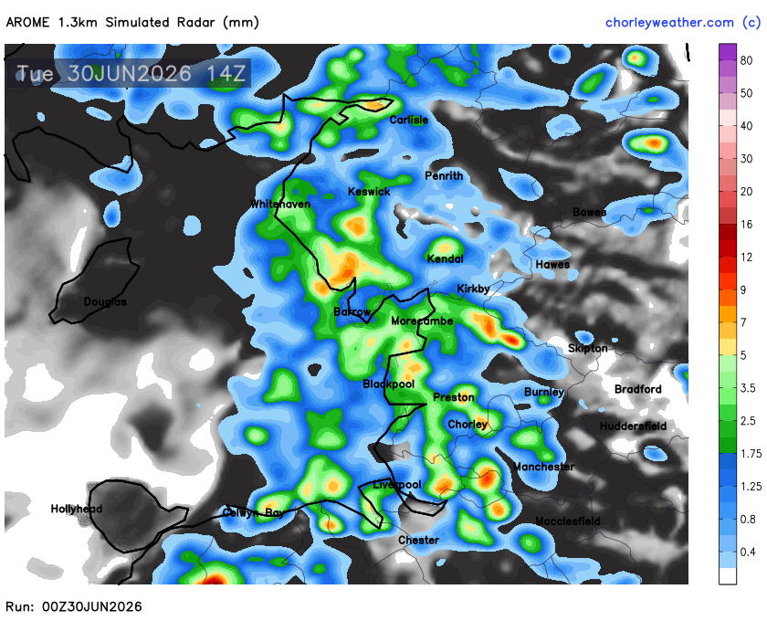
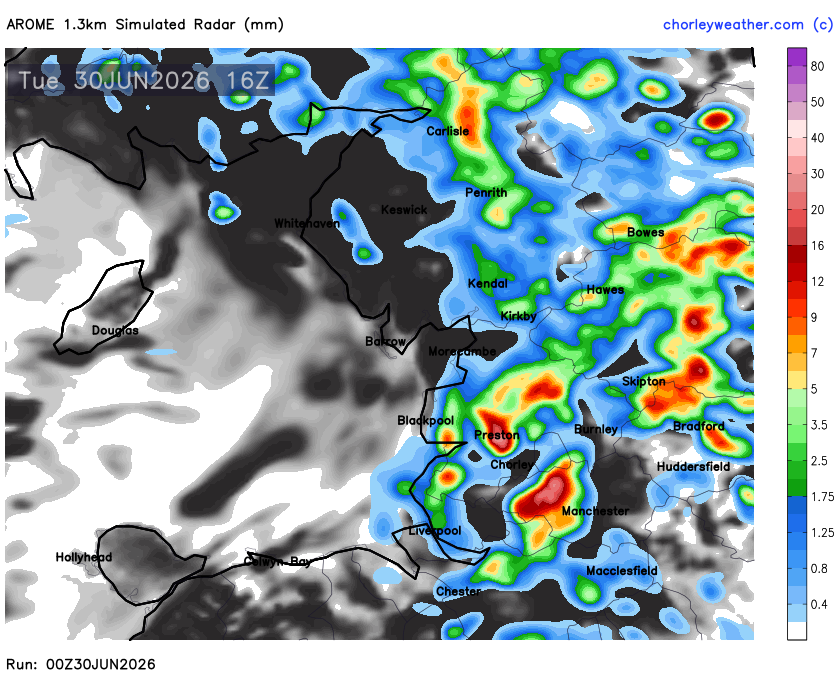
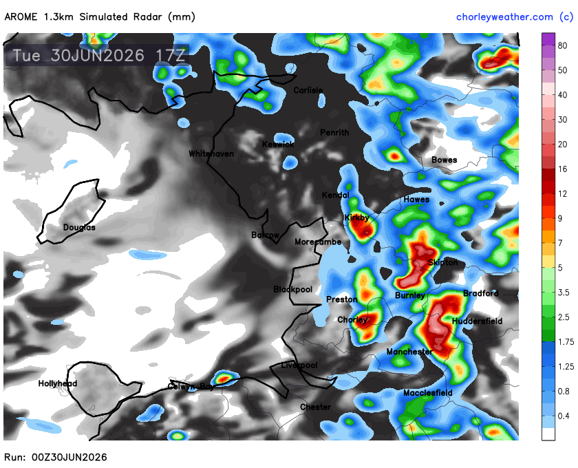
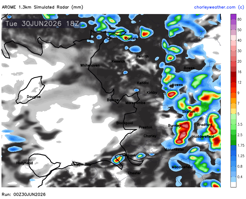
A slight risk of thunderstorms exists across North West England this afternoon as a cool upper air mass combines with warm, humid conditions at the surface. Scattered showers will quickly become heavy and thundery, particularly from early afternoon onwards, with the greatest chance of seeing the strongest storms across eastern Lancashire, Greater Manchester, the Pennines and into southern Cumbria.
While instability is only moderate, there is plenty of moisture available, meaning any thunderstorms that develop will be capable of producing torrential downpours, frequent lightning, small hail and gusty winds. Rainfall rates of 20–40mm per hour are possible beneath the most intense cells, bringing a localised risk of surface water flooding where storms linger.
The latest high-resolution guidance suggests storms will begin to develop after lunchtime before becoming most active between 2pm and 6pm. Activity should gradually ease during the evening, although a few heavy showers may persist beyond sunset.
Forecaster: Stu