This week, cold Arctic air over North America will inject fresh energy into the jet stream, setting the stage for a dynamic period of weather for north-western Europe. As the jet stream intensifies, it will act as a conveyor belt, transporting a series of low-pressure systems across the Atlantic Ocean, bringing wet and windy conditions to the region.
The Role of Arctic Air
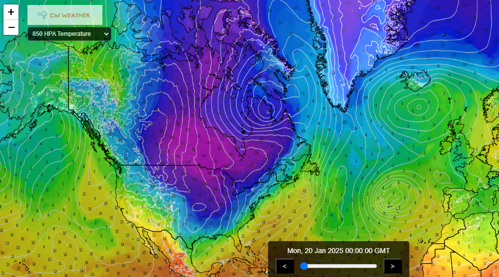
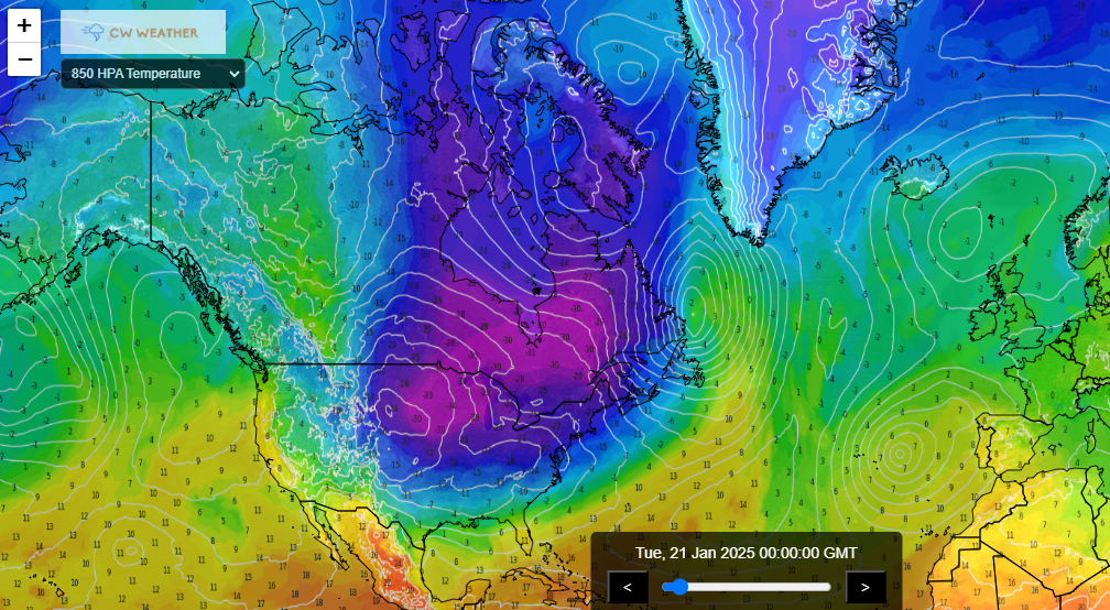
The movement of cold air masses from the Arctic into the central and eastern United States is a key driver of this week’s weather patterns. When frigid air meets milder air from the south, it creates a sharp temperature contrast. This contrast fuels the jet stream, a high-altitude ribbon of fast-moving air that steers weather systems across the globe. The stronger the temperature gradient, the more powerful the jet stream becomes.
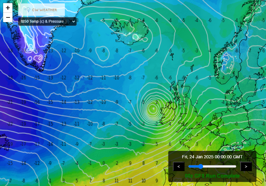
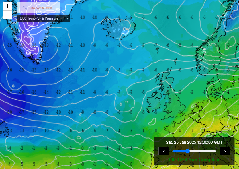
This week, a pronounced dip in the jet stream over North America will allow Arctic air to plunge southward, triggering intense cyclogenesis (the formation of low-pressure systems). These systems will then be carried eastward by the reinvigorated jet stream, crossing the Atlantic towards Europe.
Impacts on North-Western Europe
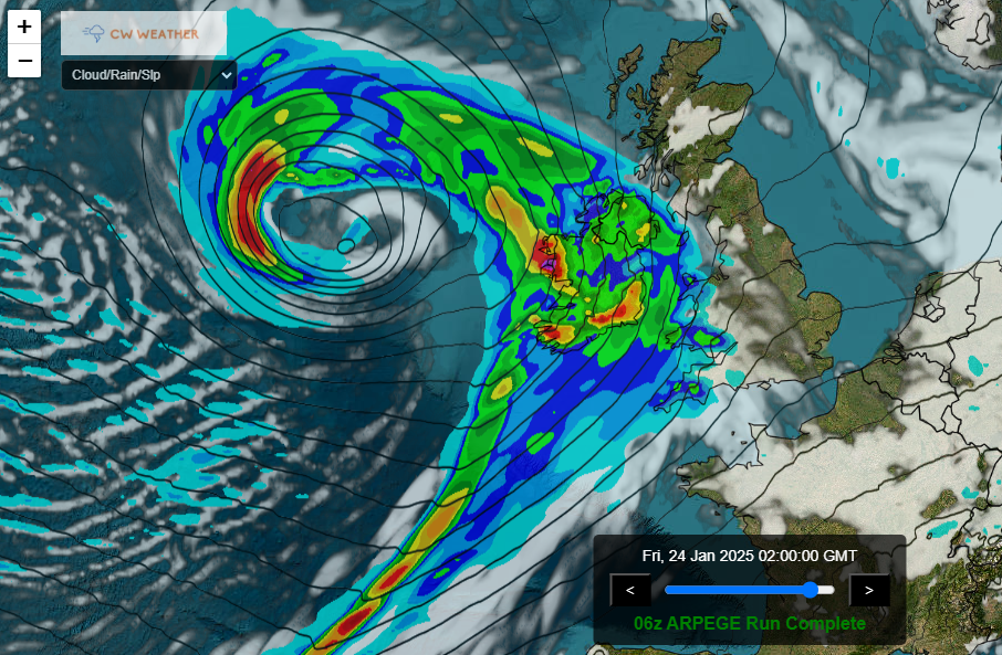
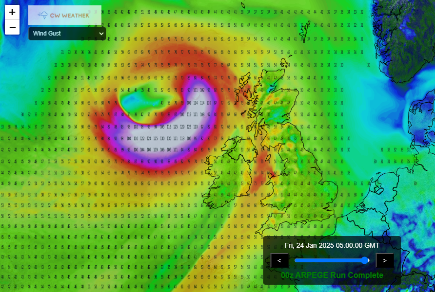
For north-western Europe, this means a stormy period lies ahead. The UK and Ireland up to Iceland are likely to bear the brunt of these Atlantic lows, with bouts of heavy rain, strong winds, and unsettled conditions expected through much of the week.
Wind and Rain
As the low-pressure systems sweep in, expect periods of intense rainfall and gusty winds. Coastal regions and exposed areas could experience particularly strong gales, with wind speeds potentially reaching 60-70 mph in some places. Localised flooding may also be a concern, especially in areas where the ground is already saturated from recent rain.
Temperature Swings
Although the incoming systems will bring milder air from the Atlantic, temperatures across the region may fluctuate significantly. Ahead of each low-pressure system, warmer air will surge in, but this will be quickly replaced by colder, more unstable air in their wake, leading to sharp temperature drops and the potential for hail or even wintry showers in higher elevations.
So a change to a more active pattern is upon us and while some say forecasting such changes is impossible in advance, take a look below at what I posted for premium members over a week ago.
So using various methods it is possible to pluck out expected patterns in advance. If you want to be privy to this information then why not join us in the premium section. Click here for more information!!!