In a mesmerising display of atmospheric dynamics, Earth’s stratosphere has recently orchestrated a rare performance, captivating scientists and weather enthusiasts alike. The spotlight falls on the unexpected reversal of winds in the stratosphere, a phenomenon that offers a fascinating glimpse into the intricate dance of our planet’s atmospheric layers.
The stratosphere, the second major layer of Earth’s atmosphere extending from about 10 to 50 kilometres above the surface, is known for its relatively stable and stratified nature. However, the typically westward-blowing winds in the stratosphere encountered an abrupt change of direction, reverting to an eastward flow. This phenomenon is often referred to as a sudden stratospheric warming (SSW) event.
One of the key drivers behind this atmospheric spectacle is the polar vortex, a large-scale circulation of air that typically resides over the polar regions during winter. The polar vortex acts as a boundary separating the cold polar air from the warmer air further south. However, under certain conditions, such as a disruption in the flow of energy from the troposphere below, the polar vortex can weaken or even split apart, leading to the onset of a sudden stratospheric warming event.
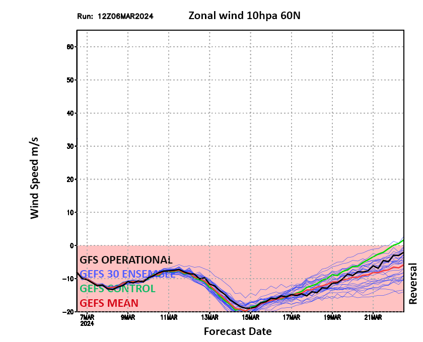
The recent wind reversal in the stratosphere is believed to have originated from such a disruption in the polar vortex. As the polar vortex weakened, the usual westward winds in the stratosphere slowed down and eventually reversed direction, ushering in an eastward flow of air. This reversal not only affects the stratosphere itself but can also influence weather patterns in the troposphere below, potentially leading to shifts in temperature, precipitation, and atmospheric circulation over various regions of the globe. There have been quite a few attempts at this through this winter alone, in fact from my perspective unusually so but never quite reaching the holy grail until now.
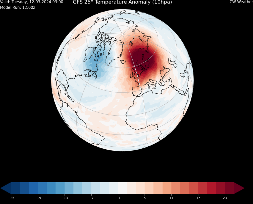
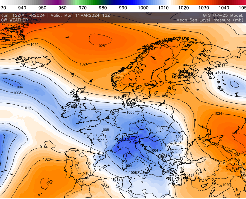
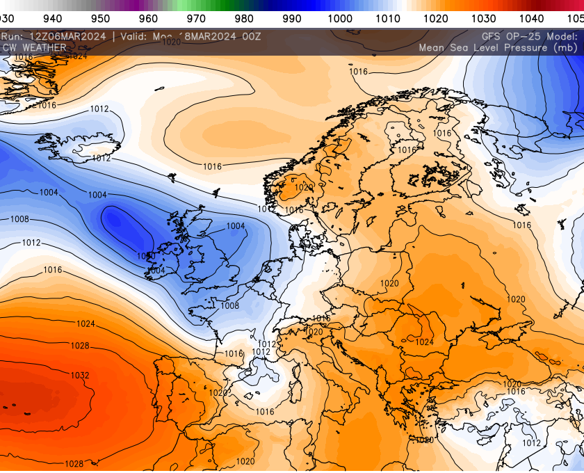
Understanding the implications of sudden stratospheric warming events is crucial for improving our ability to forecast weather and climate patterns. While these events occur relatively infrequently, their impact can be significant. Typically Europe will get colder as blocking or northern blocking supports colder feeds pouring out of the polar region.
The latest GFS data supports this pattern with blocking north of the UK or the North East, in either case low pressure will be forced south into France and at times becoming cut off. This will also promote and easterly flow of sorts but we are certainly heading out of the realms of deep winter weather as Spring attempts to stamp influence.
That being said the notion or expectancy of early summer weather may well have to be put on hold for now as the chaotic fall out from this SSW is resolved. We may not see deep colder weather as a result of the reversal but the odds are certainty stacked against an early summer onslaught. As ever I will have much more details on the upcoming patterns via the premium channels, find out more about these here!!