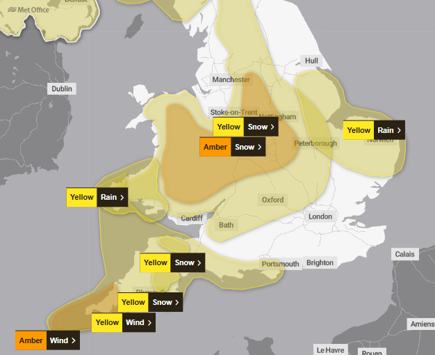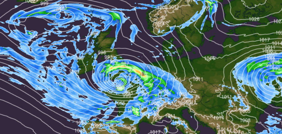
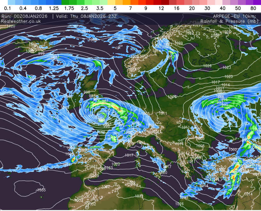
The UK’s cold spell continues as a deep area of low pressure, Storm Goretti, moves through the country bringing a combination of snow, strong winds and heavy rain. A number of Amber and Yellow weather warnings are in force from the Met Office.
Storm overview:
- The system has been named Storm Goretti by Météo-France, as the strongest winds are expected across the Channel Islands and northern France
- The storm will also have significant impacts across the UK, particularly southern England, Wales and the Midlands
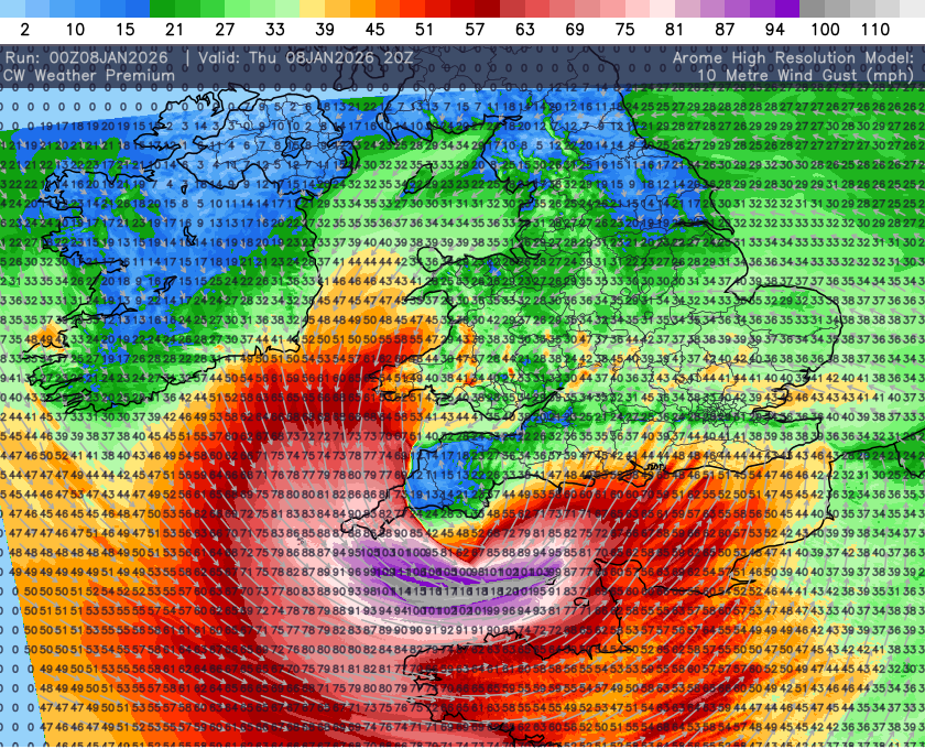
Wind impacts:
- A spell of strong to severe winds is expected on Thursday afternoon and evening
- Southern England and Wales will see gusts of 50–60 mph fairly widely
- Exposed hills and coastal areas may see 60–70 mph gusts
- An Amber wind warning is in force for Cornwall and the Isles of Scilly
- Here, 80–90 mph gusts are possible in the most exposed locations
- These winds may lead to travel disruption, power outages and coastal impacts
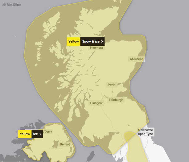
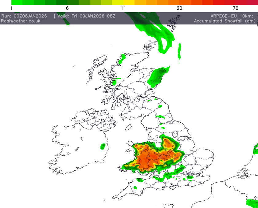
Snow risk:
- On the northern flank of the storm, a prolonged spell of snow is expected
- The greatest risk lies across Wales and parts of the Midlands, where an Amber snow warning has been issued
- Expected accumulations include:
- 5–10 cm widely
- 15–25 cm over higher ground
- Up to 30 cm locally, especially on hills
- The period of highest impact is expected Thursday night into Friday morning
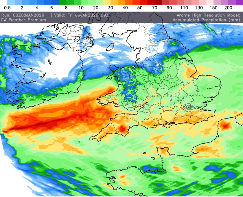
Rainfall impacts:
- Heavy rain will be an additional hazard as Storm Goretti moves through
- The greatest risk of surface water flooding is across parts of S Wales, S England and parts of eastern England
- Localised flooding and difficult driving conditions are possible
Overall assessment:
Storm Goretti will be a multi-hazard event, with snow posing the greatest risk of disruption, particularly across Wales and the Midlands. However, strong winds and heavy rain also have the potential to cause widespread disruption across southern and western parts of the UK.