Storm Ciaran will bring strong winds and heavy to parts of France and southern England late on Wednesday and through much of Thursday. The exact track it still hard to pin as yet but growing confidence is that the worst winds winds will come through the English Channel and northern France. Grab all the latest here.
Update: 01/11/23 (9.30)
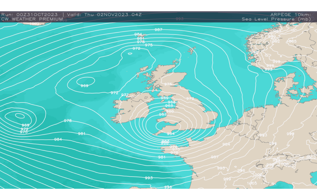
Find the latest update below. Storm Ciaran is now under going rapid cyclogeneses and will most likely produce a sting jet later today. This bring the risk of 100 mph winds, which look likely to whip through the English Channel.
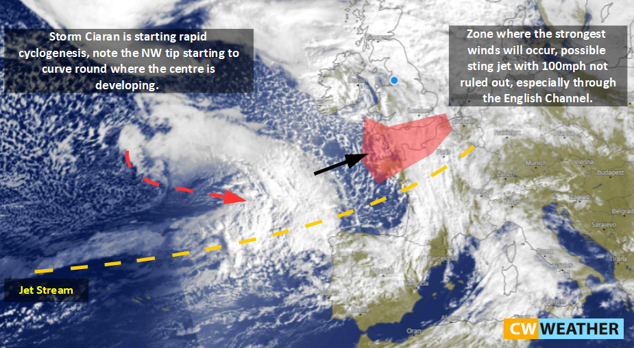
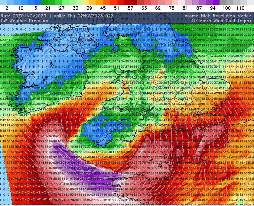
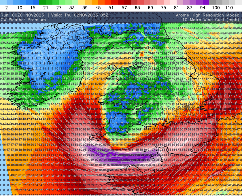
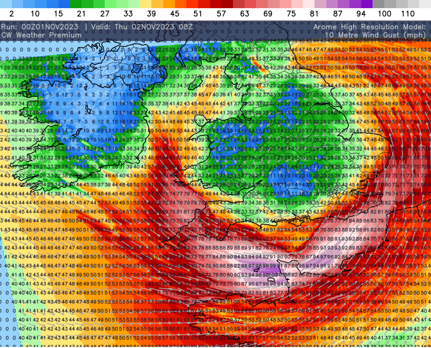
The latest arome wind gust data can be found below as well and also shows severe wind through the Channel but also across parts of Cornwall as well with severe gales running along southern coasts too!!!

31/10/23:
Extreme cyclogenesis can cause wobbles and it wouldn’t take much of a track shift to see the strong winds track across the south. For this reason the image below is where my thinking is at currently. However I must stress the strongest gusts look set to be through the Channel, I have included southern parts for the risk of track shift.
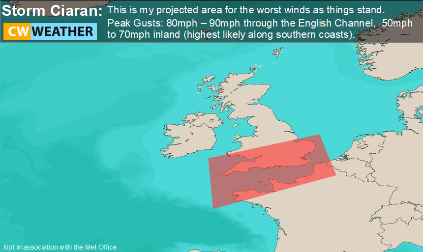
This mornings model data is hinting the track remains more south and keeps much of southern England away from the worst winds but I cant stress enough just a few miles change in track is all it will take to bring the south back into play.
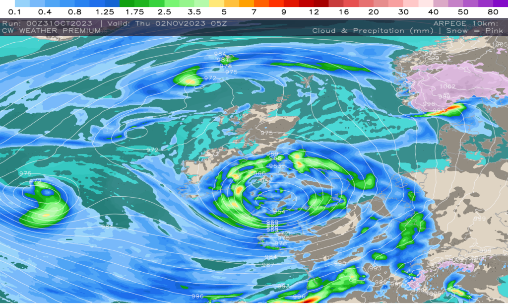
Below you see the wind animation for the expected storm and just note how a secondary low develops which will be just a strong as storm Ciaran, bringing impacts to south-west France and northern Spain.