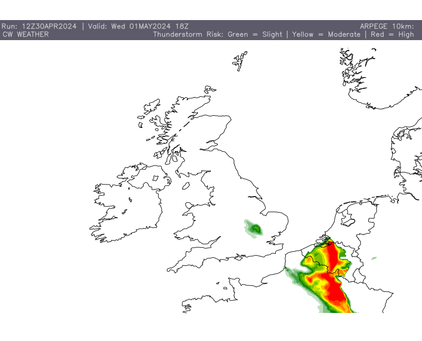
Tomorrow evening promises an electrifying show across central and northern/north-eastern France, along with a potential sprinkle of excitement in western Belgium. It’s all thanks to a warm air mass mingling with a hint of instability, brewing the perfect recipe for heavy, thunderous downpours.
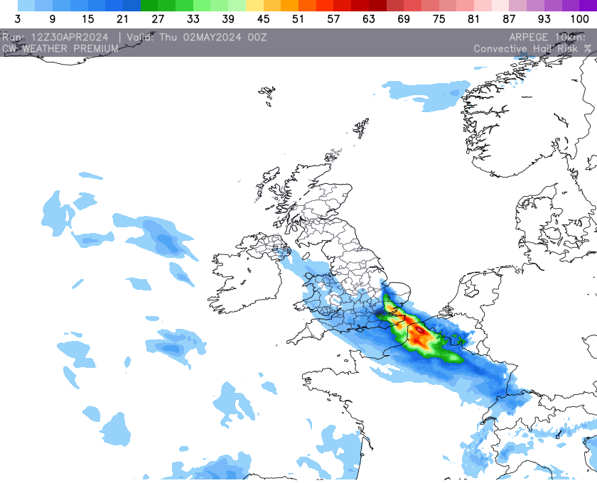
Our trusty thunderstorm risk data paints a vivid picture: red hues signal a high chance of thunderstorms bursting forth. But even as night falls, the risk remains palpable across the southern reaches of the UK, albeit with a slightly toned-down intensity.


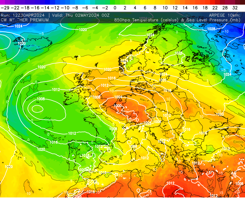
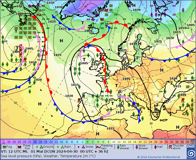
These thundery downpours will develop in and unsettled warm air mass, which has drifted eastward from Germany. Curiously, this air embarked on its journey from the sunny Mediterranean, taking a scenic route through Italy before settling in Germany. A warm front separates this warmer air mass from the colder air mass to the east. Where this boundary lays is where the developments are most likely to occur.
The latest intel suggests these storms might graduate to a more organised state, with whispers of supercells or even the grandeur of a Mesoscale Convective System (MCS). Brace yourselves, as these formidable formations could unleash hailstones of considerable size in localised areas.
Using the freshest high-resolution AROME data, meticulously brewed in-house, we can see the thundery developments blowing up across central France before drifting intentionally north into northern/north-eastern France before heading into southern parts of the UK. Western Belgium may come tantalising close but ultimately may miss out this time.