The UK is bracing for impact as Storm Lilian, a powerful and rapidly developing weather system, is set to hit the country on Friday morning. There are warning of widespread disruption, with high winds, heavy rain, and coastal flooding expected across large parts of the UK.
The Path of Storm Lilian
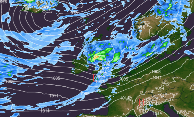
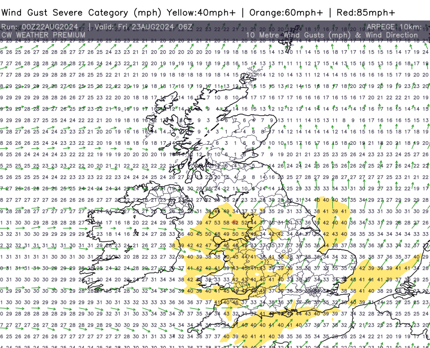
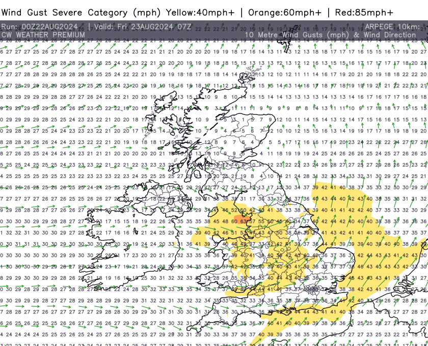
Storm Lillian, still in development stage, will quickly gain strength as it moves eastward towards the British Isles. It is anticipated to make landfall early on Friday morning, primarily affecting western regions before sweeping across the rest of the country throughout the day. The Met Office has issued several weather warnings in anticipation of severe conditions, particularly in western coastal areas where wind speeds could reach up to 80 mph in exposed locations.
Wind and Rain Warnings
The most significant threats posed by Storm Lilian are the high winds and heavy rainfall. Models predict that wind gusts could exceed 40-50 mph across many parts of England and Wales, with even stronger gusts expected along the coasts of North Wales, NW England, and parts of Northern England. These winds are likely to cause damage to buildings, downed trees, and widespread power outages.

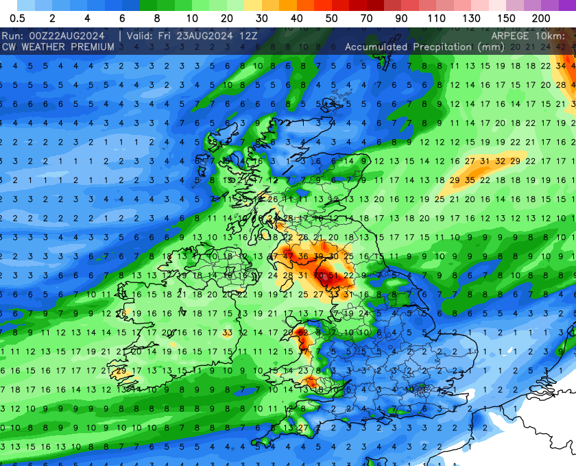
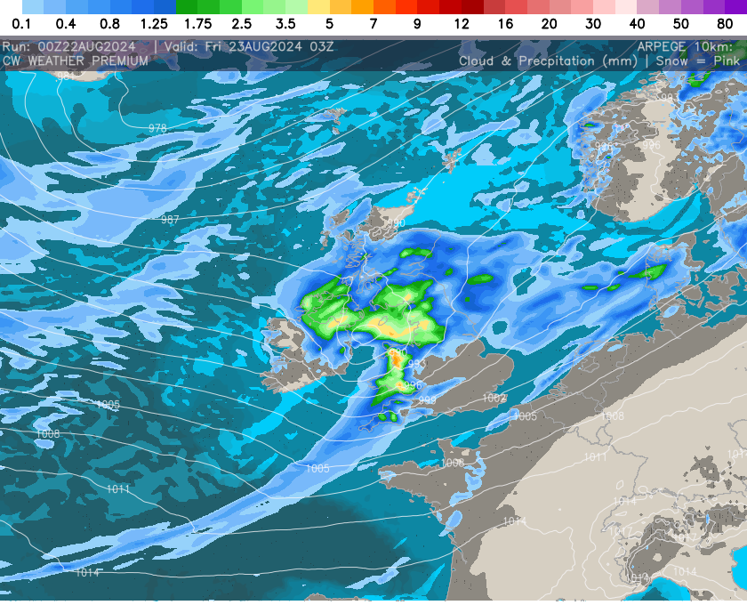
In addition to the winds, Lilian is expected to bring torrential rain, particularly in western and northern regions. Rainfall totals could reach up to 70 mm in some areas, raising concerns about localised flooding in low-lying regions and areas with already saturated ground from previous rains this week. Rivers may swell quickly, potentially leading to flash flooding in vulnerable areas.