CW Weather Convective Outlook – North West England
Valid: Friday afternoon and evening, 26 June 2026
Risk type: Isolated to scattered thunderstorms, locally intense
Confidence: Moderate on environment, lower on exact storm placement
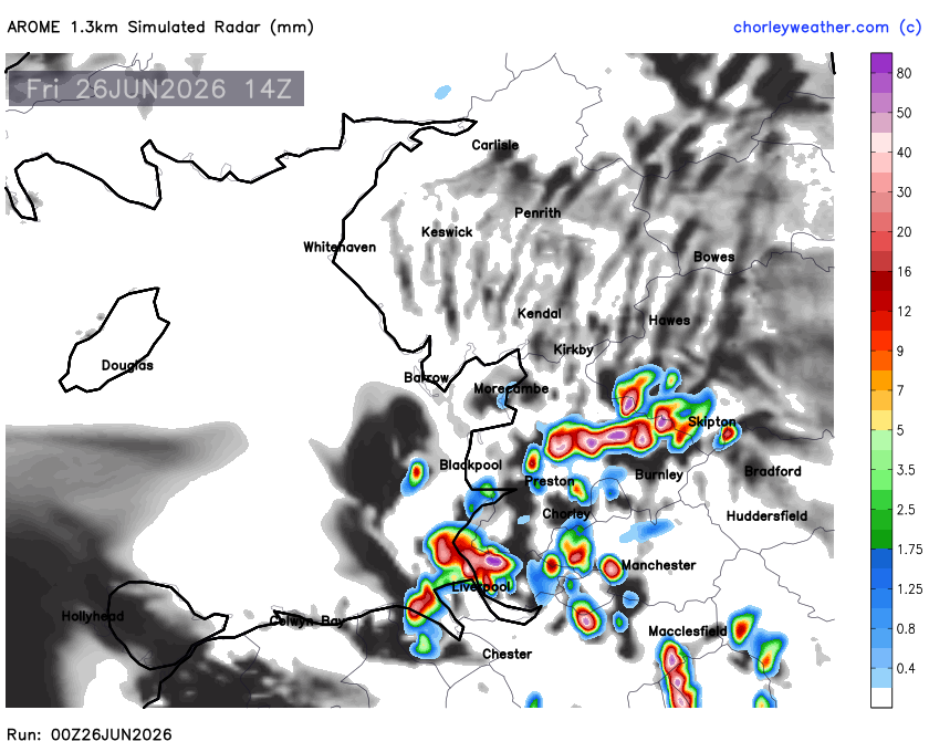
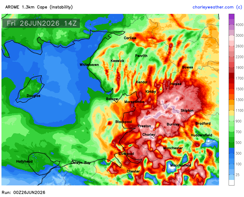
A very volatile airmass remains established across North West England this afternoon. Strong June sunshine combined with exceptionally high dew points around 20–24°C will allow temperatures to climb into the low 30s across many inland districts. The resulting environment will become increasingly unstable, with AROME model indicating widespread moderate to locally extreme CAPE across Cheshire, Merseyside, Greater Manchester, Lancashire and the Pennines
Unlike many widespread thunderstorm events, large-scale forcing appears relatively weak. Instead, convective initiation is expected to rely on smaller-scale features. A developing Irish Sea sea-breeze convergence zone pushing inland during the afternoon, together with differential heating boundaries and the natural lift provided by the Pennines, should provide sufficient focus for isolated convective development where the cap is locally breached.
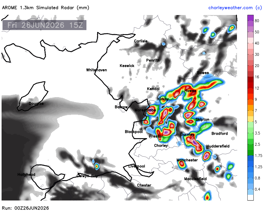
Once storms develop, the thermodynamic environment is highly supportive of rapid vertical growth. Very warm 850mb temperatures around 17–19°C overlay an exceptionally moist boundary layer, while precipitable water values approaching 30mm suggest storms will be highly efficient rainfall producers. Any mature cell could therefore produce torrential downpours, frequent lightning, localised flooding and strong downburst winds despite relatively modest background flow.

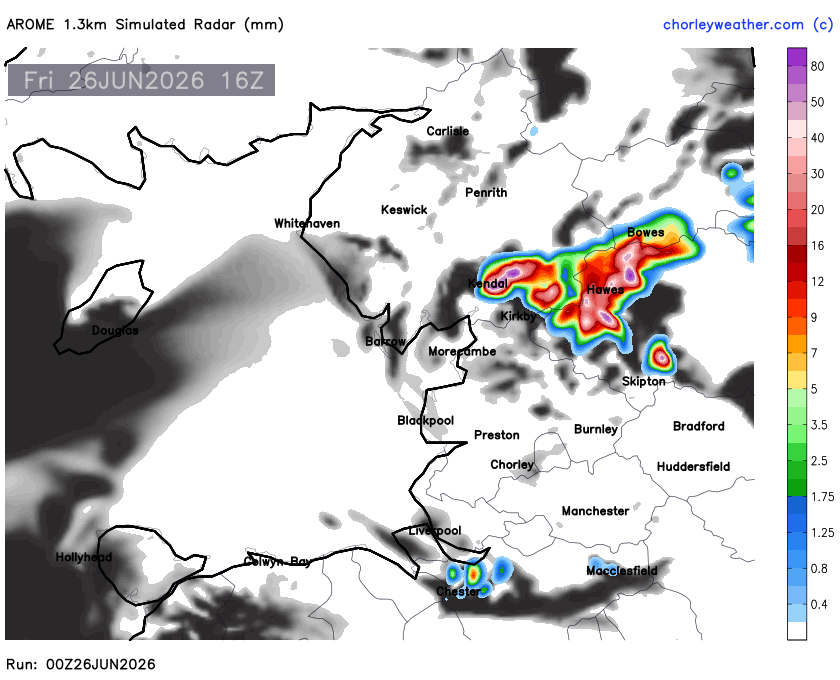
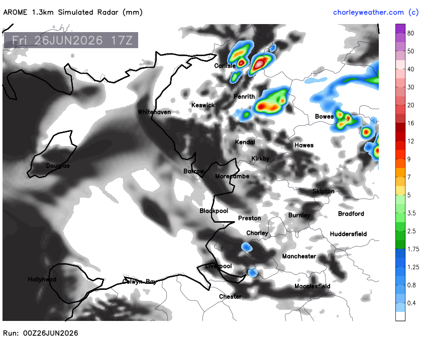
Storm coverage is unlikely to become widespread, with many places remaining dry throughout. However, confidence is increasing that where mesoscale boundaries interact during the mid to late afternoon, thunderstorms may intensify quickly, particularly from inland Merseyside and Cheshire through Greater Manchester, Chorley, eastern Lancashire and the western Pennines. Additional development over the Pennines may then drift north or northeast during the evening before gradually weakening after sunset.
Overall Assessment: Moderate Risk of severe thunderstorms across inland North West England. While coverage should remain isolated, any storm that develops has the potential to become locally intense due to the combination of extreme instability, tropical moisture, and subtle convergence boundaries.