Weather Advisory Issued For Strong Winds – Saturday 4th April 2026
A rapidly deepening area of low pressure, Storm Dave, will move northwards across the UK on Saturday, passing through Scotland overnight before clearing into the North Sea on Sunday.
For north west England, conditions will deteriorate through Saturday afternoon, with winds strengthening steadily from the southwest.
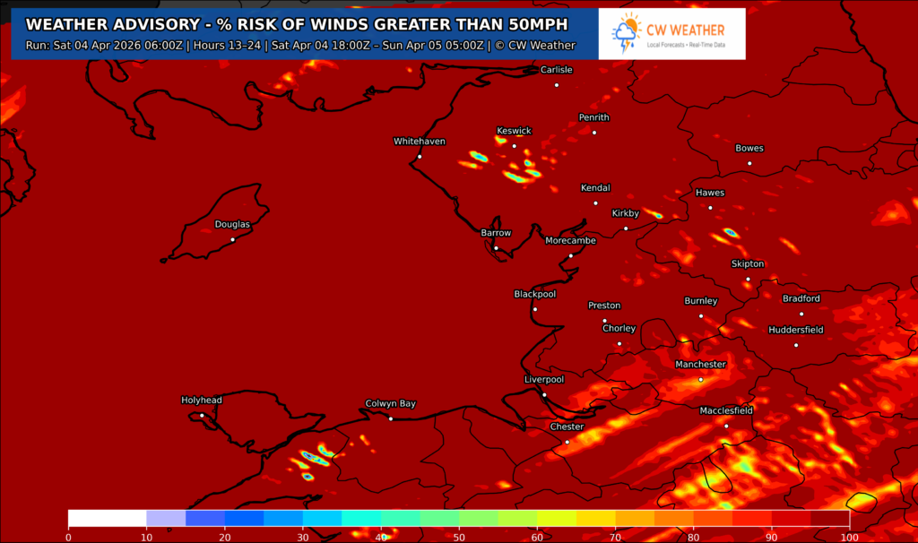
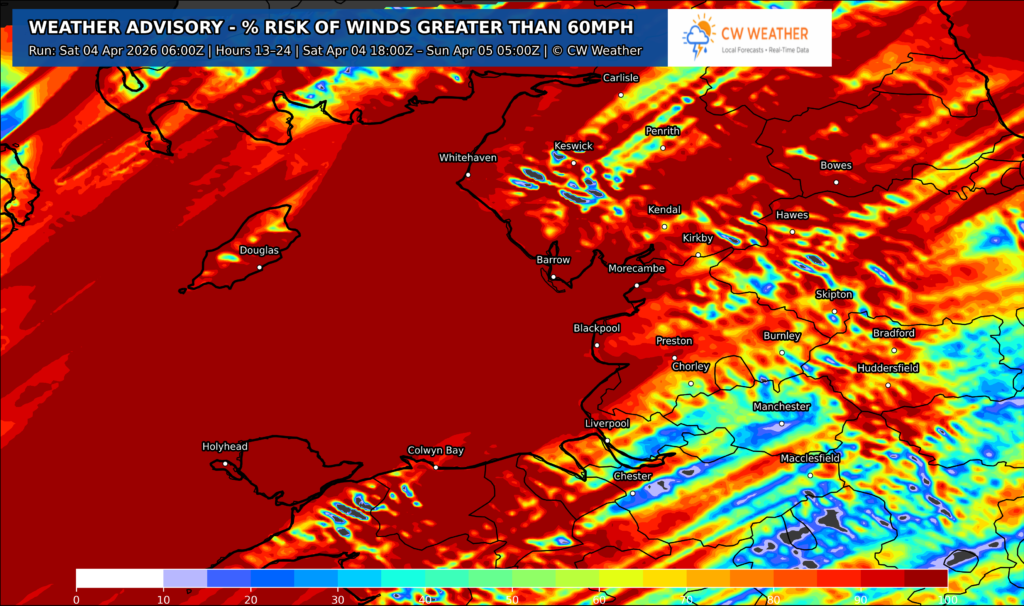
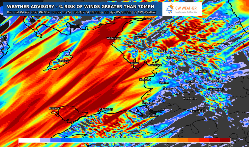
During Saturday evening and overnight, a spell of very strong southwesterly winds veering westerly is expected. Winds will be the main feature, becoming widespread and potentially disruptive.
- Widely: gusts of 50–60 mph
- Coastal and exposed areas (e.g. Irish Sea coasts, hills): 70–80 mph possible
The strongest winds are most likely during the evening and night, before gradually easing from the west towards dawn on Sunday.
Alongside the wind, there will be spells of rain, though these are not expected to be the primary hazard.
Issued Saturday 4th of April @4/4/26