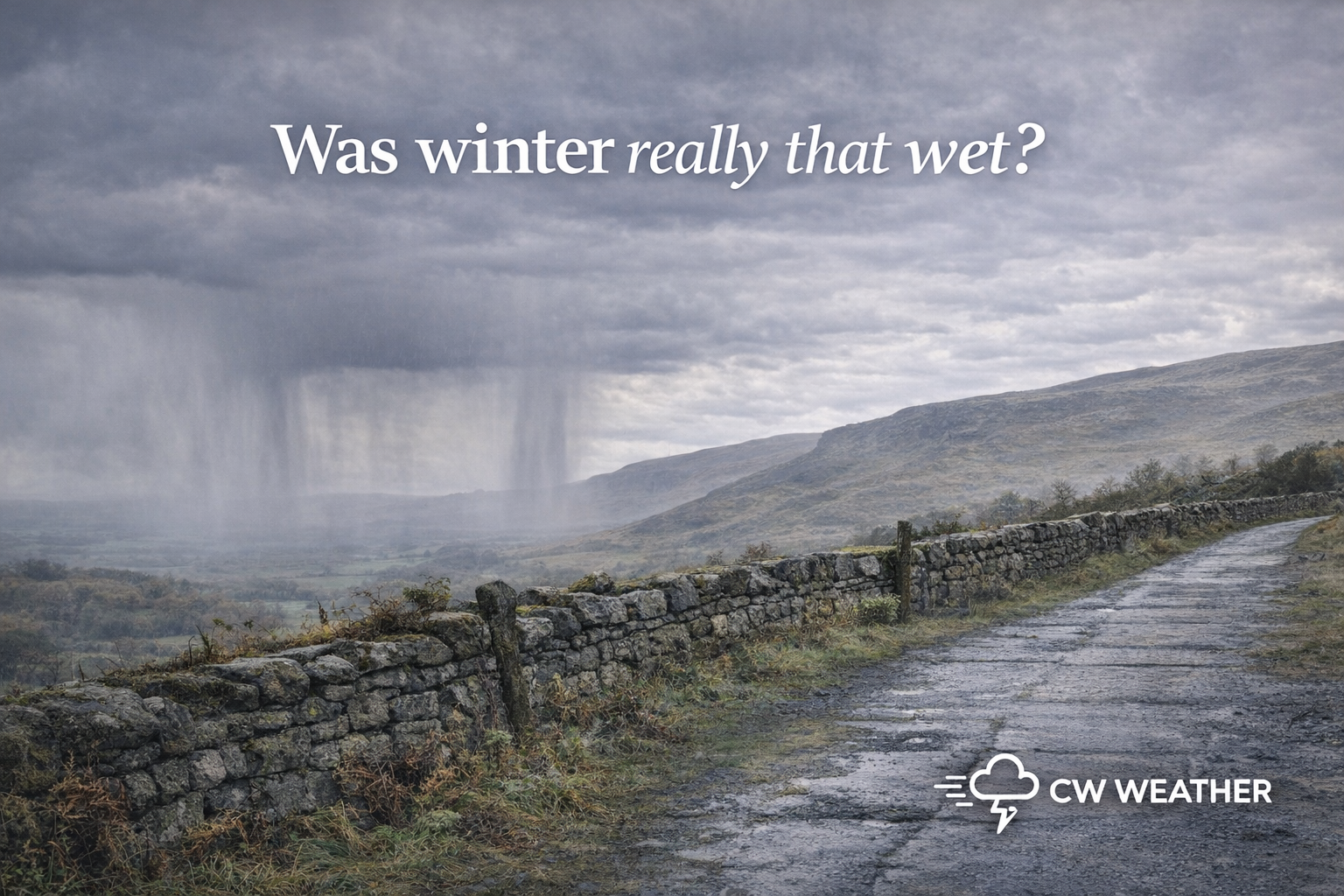
A Wet Turn After a Mixed Start, Winter Rainfall Review for NW England.
Winter 2025–26 delivered a highly contrasting rainfall story across North West England, evolving from a relatively uneventful early winter into a markedly wetter second half of the season.
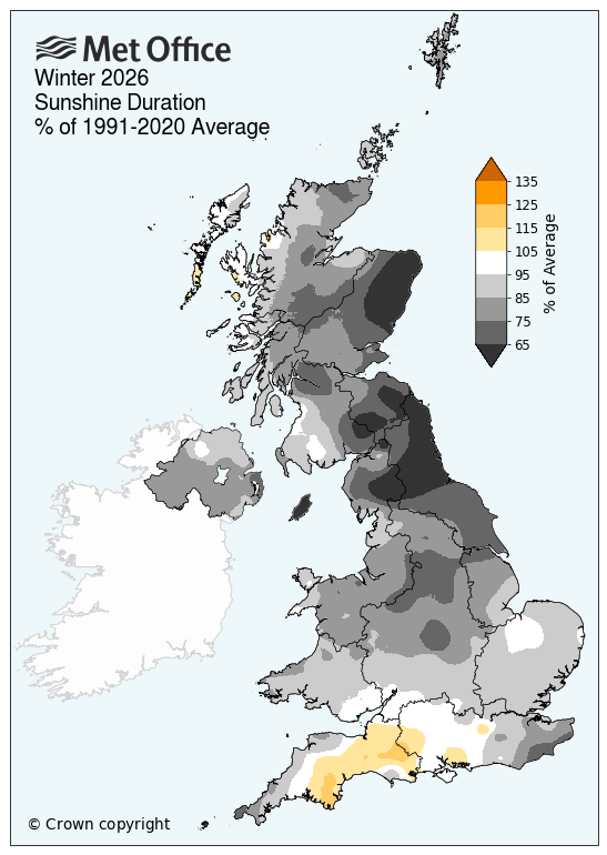
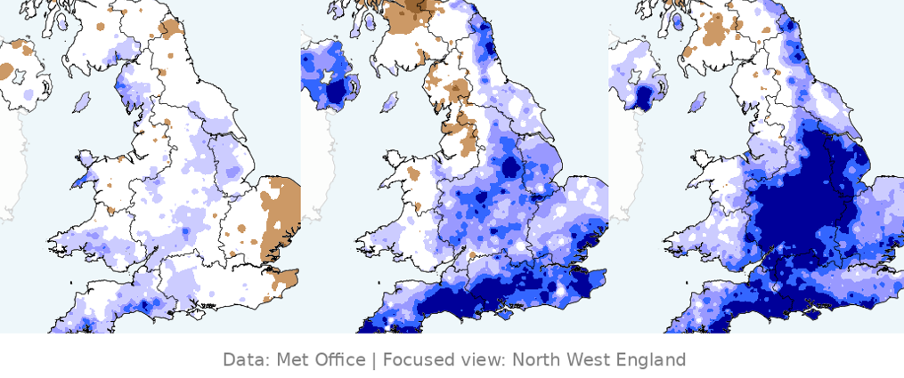
Using Met Office rainfall anomaly data (percentage of the 1991–2020 average), we can clearly see how the season progressed month by month.
December 2025 — A Near-Average Start
December began winter in fairly subdued fashion across North West England.
Rainfall totals were generally close to average, with many areas showing only modest departures either side of normal. Some pockets leaned slightly drier than average, particularly inland areas away from exposed western uplands but across Cumbria there was slightly above average rainfall.
Key characteristics:
- Mostly near-normal rainfall
- Limited prolonged Atlantic storm activity
- No sustained wet regime established
- Typical winter variability rather than extremes
For many locations, December felt fairly ordinary — neither notably wet nor especially dry by regional standards.
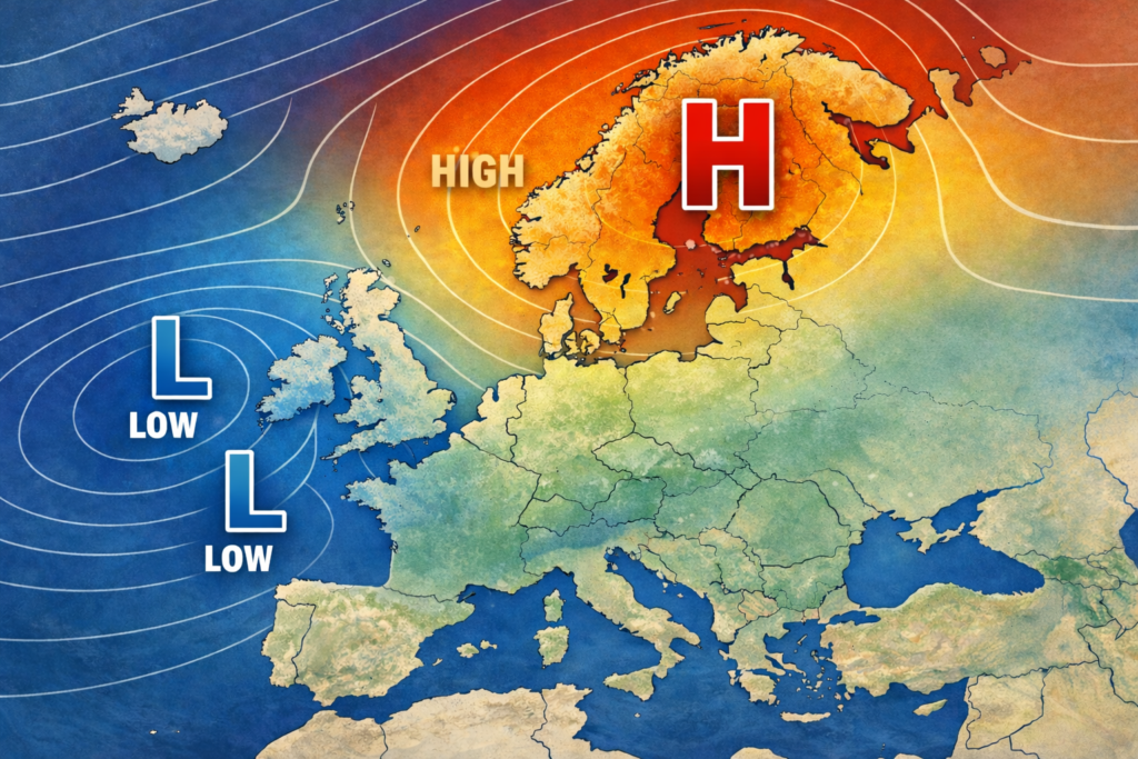
January 2026 — Atlantic Influence Strengthens
January marked a clear transition toward a wetter pattern.
North West England for large parts saw below average rainfall yet Atlantic systems tracked more frequently across the UK, bringing repeated spells of rain and stronger frontal activity. However given the flow often turned easterly or south-easterly the North West can be sheltered at times which has meant lower rainfall totals. This doesn’t mean it didn’t rain, we just got less than normal in large parts of the region.
- Rainfall increased noticeably across the UK but we where sheltered from the heaviest.
- There where more frequent frontal rainfall events.
- Greater persistence of unsettled conditions but not as wet as further south.
While not exceptional everywhere, January represented the turning point of the winter — the atmosphere shifting into a more zonal, Atlantic-driven regime later in the month.
February 2026 — Wet Conditions Take Over
February was the standout month of the season.
Large parts of North West England experienced rainfall day after day , and yet the final overall totals for the month came in only average to slightly above. Again this could be the presence of east or south-easterly flow for the first parts of the month but the flow did switch more westly as the month progresses so it was a wetter second half to the month realistically.
What drove this?
- Atlantic jet stream positioning change
- Repeated low-pressure systems
- Blocking patterns easing
- Saturated ground amplifying impacts
By February:
- Rainfall became consistently normal by day
- Soil moisture remained wet through limited sunshine
- Wet conditions dominated rather than arriving in isolated events
If we take the winter as a whole then we can see quite a mix across the region. Locally some regions saw slightly below average rainfall but others slightly above but this was far from breaking any records, despite the conception we stayed wet all winter.
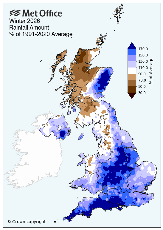
I think what drove this misconception was how dull it was. Through winter across the region it was often dull and uninspiring. We saw very little in the way of frost, we did have some but not much. The sun didn’t shine for any length of time to make it notable. The data for winter backs this up with much duller than average weather across large swathes of the UK, not just our region. This can often make winter feel like its dragged on, especially when the last third was often wet too.