Upside down weather is the only way to describe the pattern through September as the Atlantic jet stream remained generally south or across the south of the UK. This ensured unsettled weather remained across the south with pressure tending to be higher across the north and with it more in the way of settled weather.
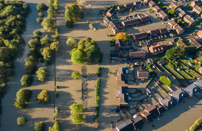
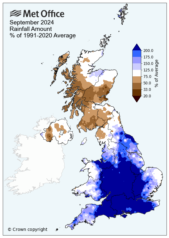
Rainfall will be the feature of note for September Rainfall but there was strong regional variation, with central and southern England seeing well above average values. Several counties including Bedfordshire, Gloucestershire and Oxfordshire provisionally recorded their wettest September on record, with over 300% of the average September rainfall. Southern England overall recorded its third wettest September on record, and its wettest since 1918. As you can also see a good portion of Scotland remained drier than average, especially western parts which in part shows a lengthy period of easterly winds as lows crossed the south.
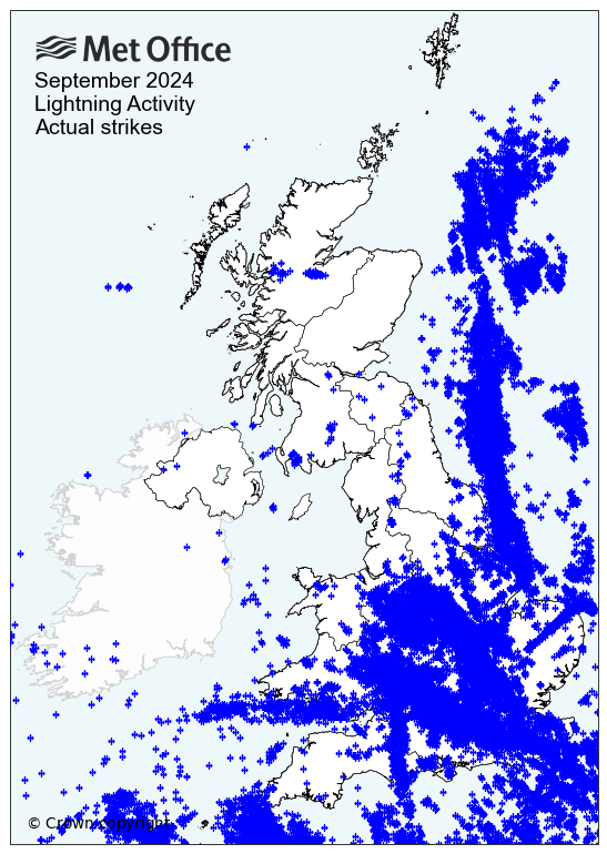
Thundery downpours also contributed to the regional variation in rainfall amounts and you can see the storms via the lightning tracker for the month. The south just didn’t get much respite at all and the ground remained sodden through much of the month.
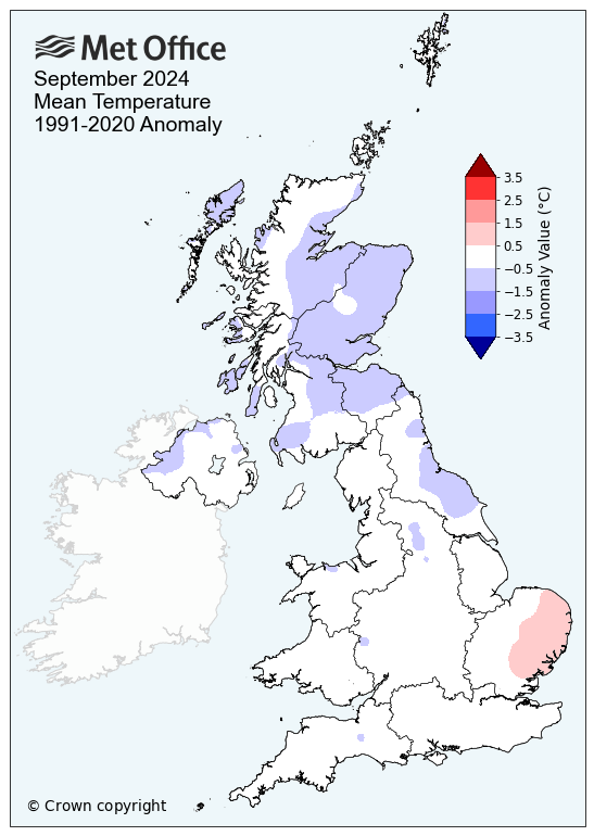
Temperatures varied across the month but we started the month well with high pressure bringing fine weather generally and with it warmer weather but this soon changed, and overall through the month we ended up cooler than average with a mean of 12.7°C, an anomaly -0.3°C. The central England values was slightly warmer at 14c, this owing to the fact than the north was indeed cooler at times. Nevertheless September 2024 came in at a record 17c, so quite the change. Using 1991 to 2020 climatology, the UK came in broadly average to slightly below average.
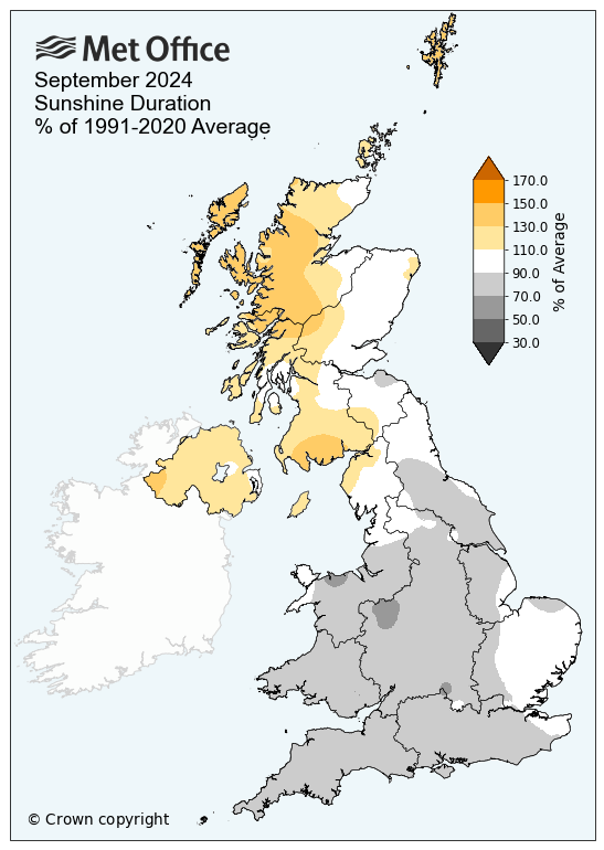
Finally we take a look at sunshine amounts for the country. No surprise to see those drier areas in Scotland, where also the sunniest and equally where you had the rain through the month, here you saw the dullest conditions and further highlights the “upside weather”.
