
Heavy rainfall, Snow & Strong Winds expected on Thursday 8th and Friday 9th of January !!!
From the Met Office (updated 7/1/26)
YELLOW WARNING:
Thursday 8th & Friday 9th Jan:
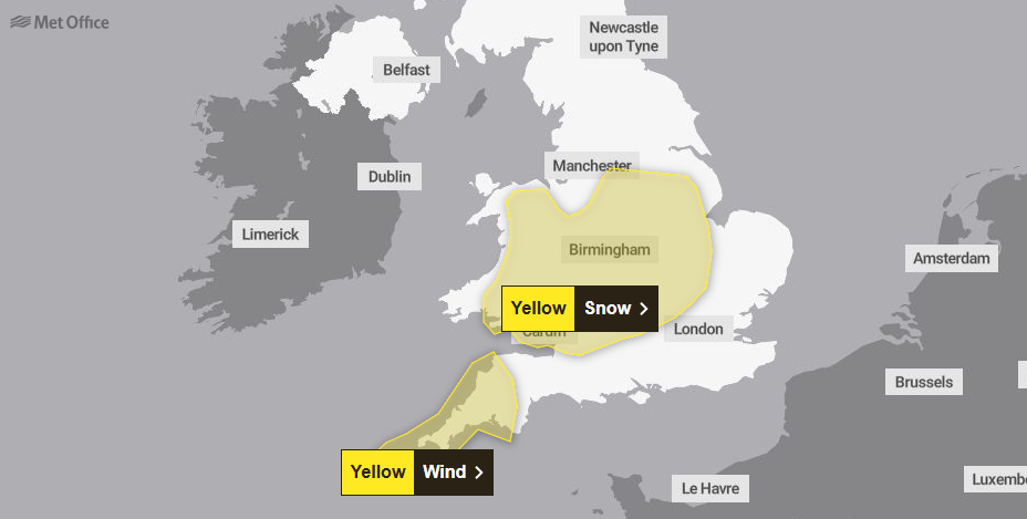
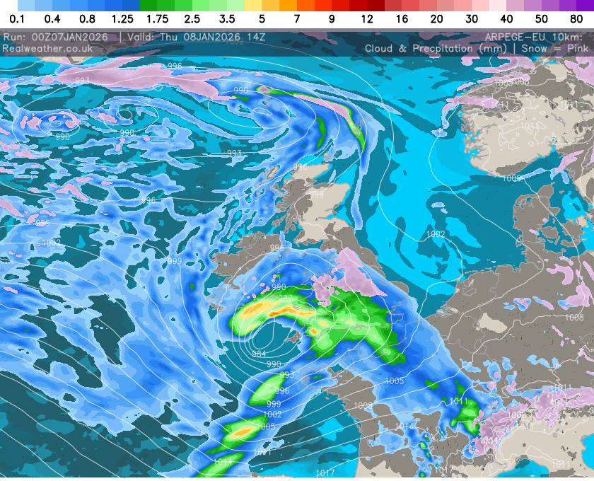
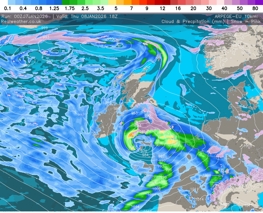
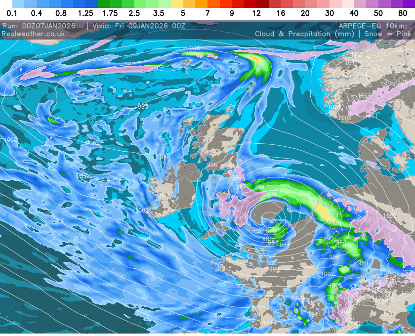
Central and Southern UK – Heavy Rain, Snow & Wind
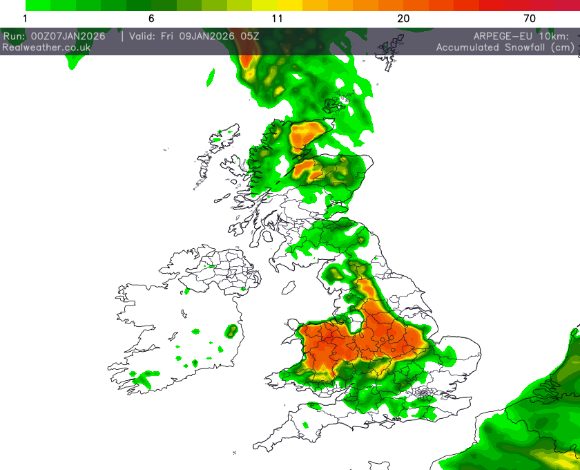
A deep area of low pressure will move across the south of the UK during Thursday and into Friday bringing a mixture of rain, snow and strong winds. A spell of heavy snow is likely to develop over higher ground in south Wales later on Thursday before rain turns to snow more widely over parts of England and Wales during Thursday night. In some areas, 5-10 cm of snow may settle with the potential for up to 20 cm in some locations, especially over higher ground. Strong winds may lead to some drifting of snow. Rain and snow will then clear eastwards during Friday. Strong northwesterly winds are expected to develop on Thursday afternoon across parts of southwest England before easing overnight. Gusts of 50-60 mph are likely but could reach 70 mph around exposed headlands and coasts. This system has been named by Meteo France as the strongest winds associated with Storm Goretti are most likely over northern France.
Thursday 8th & Friday 9th Jan:
Central and Southern UK – Heavy Rain, Snow & Wind
A deep area of low pressure will move across the south of the UK during Thursday and into Friday bringing a mixture of rain, snow and strong winds. A spell of heavy snow is likely to develop over higher ground in south Wales later on Thursday before rain turns to snow more widely over parts of England and Wales during Thursday night. In some areas, 5-10 cm of snow may settle with the potential for up to 20 cm in some locations, especially over higher ground. Strong winds may lead to some drifting of snow. Rain and snow will then clear eastwards during Friday. Strong northwesterly winds are expected to develop on Thursday afternoon across parts of southwest England before easing overnight. Gusts of 50-60 mph are likely but could reach 70 mph around exposed headlands and coasts. This system has been named by Meteo France as the strongest winds associated with Storm Goretti are most likely over northern France.
Live Warnings Europe
The warning map is used in line with Creative Commons Attribution 4.0 International License (CC BY 4.0) and with credit to EUMETNET – MeteoAlarm.
Additional data supplied by CW Weather


