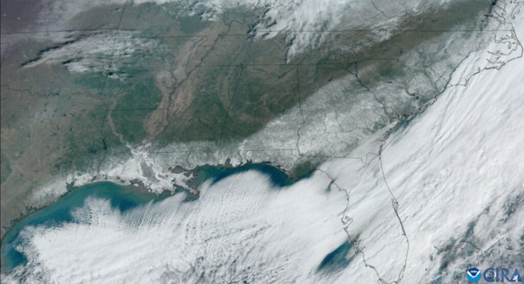
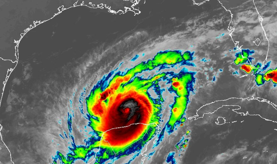
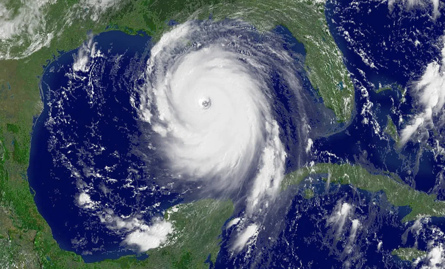
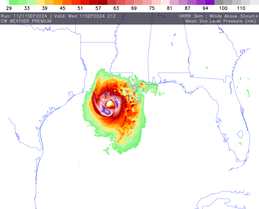
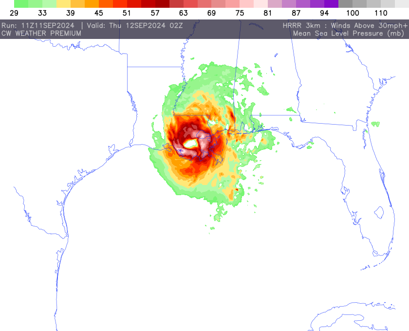
Later Today Hurricane Francine, a rapidly intensifying storm in the Gulf of Mexico, is projected to make landfall today along the Louisiana coast as a Category 2 hurricane, with sustained winds of around 100 mph. The storm, which has already prompted widespread evacuations and state emergency declarations, poses significant threats to parts of Texas, Louisiana, Mississippi, and Alabama
Key Areas of Impact:
Louisiana: The state is bracing for direct landfall, with hurricane warnings issued from Sabine Pass to Morgan City. Mandatory evacuations have been ordered in low-lying areas such as Grand Isle, Lafitte, and Terrebonne Parish. Schools and businesses are closed across the region in preparation for flooding and wind damage.
Texas: Coastal regions in Texas, including Galveston, have implemented emergency measures, with local officials warning of potential storm surges and flooding. South Texas is also under a tropical storm warning.
Alabama and Mississippi: Although not expected to face the storm’s full brunt, both states are preparing for heavy rain and wind. Flash flood warnings are in effect, and coastal communities are anticipating minor to moderate flooding, particularly around Mobile Bay.

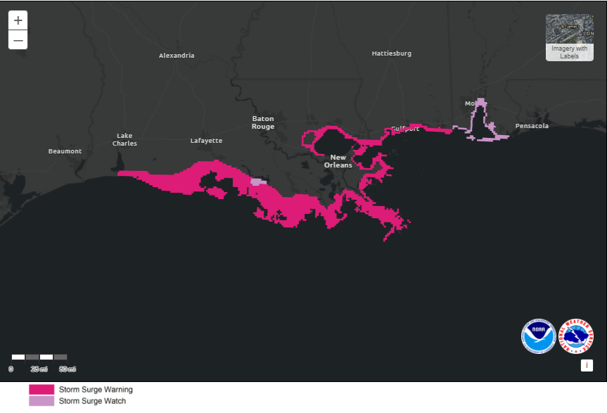
Storm Surge:
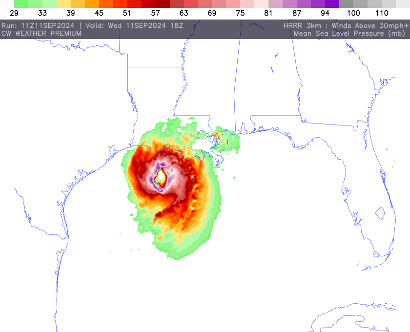
STORM SURGE: The combination of a dangerous storm surge and the tide will cause normally dry areas near the coast to be flooded by rising waters moving inland from the shoreline. The water could reach the following heights above ground somewhere in the indicated areas if the peak surge occurs at the time of high tide.
- Intracoastal City, LA to Port Fourchon, LA…5-10 ft
- Vermilion Bay…5-10 ft
- Port Fourchon, LA to Mouth of the Mississippi River, LA…4-7 ft
- Mouth of the Pearl River, LA to Ocean Springs, MS…4-6 ft
- Lake Pontchartrain…4-6 ft
- Ocean Springs, MS to MS/AL Border…3-5 ft
- Cameron, LA to Intracoastal City, LA…3-5 ft Lake Maurepas…3-5 ft
The deepest water will occur along the immediate coast near and to the east of the landfall location, where the surge will be accompanied by large and dangerous waves
Weather Hazards:
Wind and Tornadoes: Francine’s wind gusts could exceed 40 mph in areas well outside the storm’s centre, with the possibility of quick-developing tornadoes in south-western Alabama and surrounding regions.
Rainfall and Flooding: Expected to drop 2-4 inches of rain across a wide area, Francine poses a significant flood risk, particularly in urban areas and low-lying coastal regions.
The storm’s intensity is expected to weaken slightly after landfall, but Francine will continue to bring tropical storm conditions as it moves inland through the southern U.S. over the next 48 hours. Local authorities are urging residents to follow evacuation orders and prepare for extended periods without power.
Stay tuned for updates from the National Weather Service and local emergency management agencies as Hurricane Francine approaches.