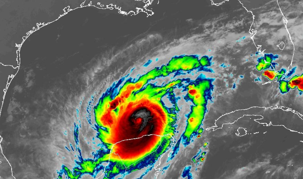
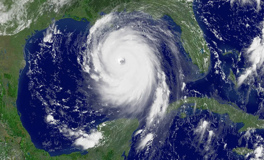
Hurricane Milton rapidly intensified into a Category 5 hurricane yesterday as it travels east through the Gulf of Mexico on its approach to Florida, with maximum sustained winds recorded at 180 mph. This marks Milton as one of the most powerful storms to threaten the Gulf Coast in recent memory. Its central pressure overnight has dropped to an extremely low 897 mb, which is indicative of a highly potent storm.
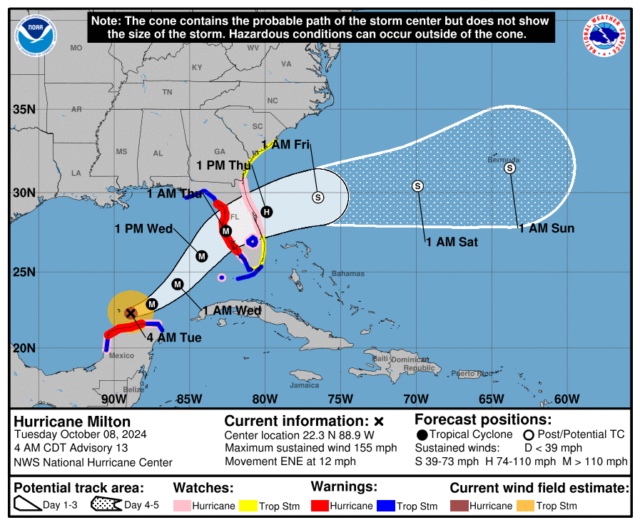
Milton’s development has been particularly alarming, transitioning from a tropical storm to a Category 5 hurricane in a very short time frame. The National Hurricane Centre (NHC) described the intensification as “explosive,” with experts noting that such rapid strengthening is rare. Only a few storms have reached such wind speeds in the Gulf of Mexico since 1950.
Milton currently remains strong but not as strong due to ongoing eyewall replacement but further streghening thereafter may well occur on the approach to Florida. Milton is highly likely to be a major hurricane on landfall but will encounter upper level wind shear (sub tropical jet) which may inhibit further strengthening. A good thing right? Actually no, this will make the system grow larger in essence, yes the peak winds may reduce but the wind field size will increase and as such the risk of catastrophic storm surge increases.
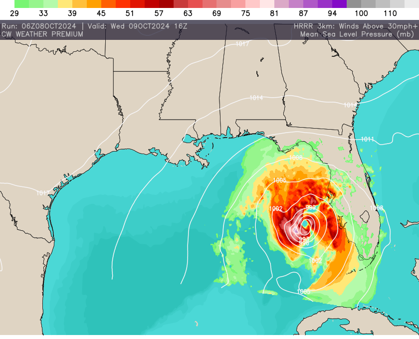
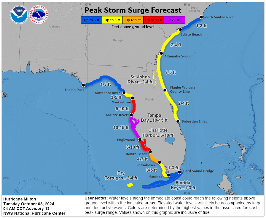
The storm is expected to make landfall on Florida’s Gulf Coast late Wednesday or early Thursday, bringing with it dangerous storm surges projected to reach as high as 15 feet in some areas. This poses a significant threat not only to coastal communities but also to inland areas due to flooding. 15ft storm surge for example would just about rise to the roofs of most UK two story houses, simply not survivable especially given a lot of properties along this coastline will be single story.
In response to the impending storm, local authorities are urging residents to prepare for severe weather conditions, including securing homes and having emergency supplies ready. The NHC has classified Milton as posing an “extremely serious threat,” highlighting the life-threatening potential of the storm.

