Hurricane Ernesto, a tropical storm that has gathered strength in the Atlantic, is expected to impact the UK in the coming days. While hurricanes rarely hit the UK with full force, remnants of these storms often bring unsettled weather conditions across the country. Here’s what to expect as Ernesto approaches our shores.
1. Transformation into a Post-Tropical Storm
By the time Ernesto reaches the UK, it will have transitioned from a tropical hurricane into a post-tropical storm. This means that while it may no longer exhibit the tightly organised system characteristic of a hurricane, it can still carry intense winds, rain, and turbulent conditions.
Tropical storms typically weaken when they move into cooler waters, which is exactly what happens as they head toward the UK. Nonetheless, Ernesto is expected to retain enough power to bring a wave of impactful weather across the country.
2. Heavy Rainfall
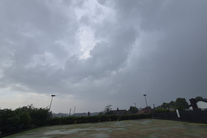
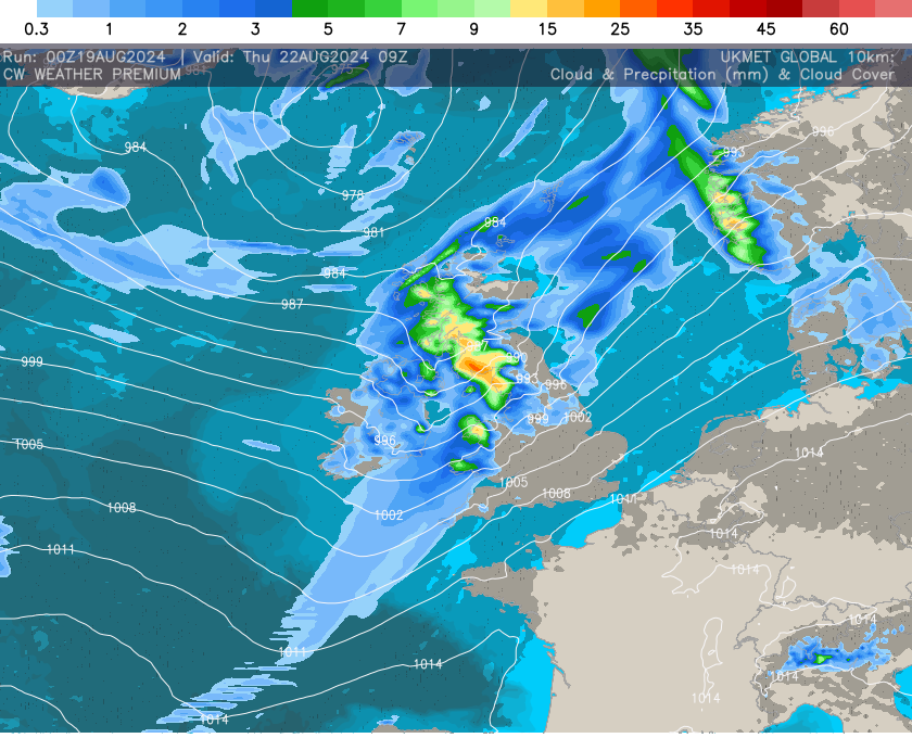
The most significant effect of Ernesto’s remnants is likely to be heavy rainfall. Model forecasts suggest widespread rain, with localised downpours, particularly in western and northern regions of the UK. Rainfall totals could be substantial, with areas in Scotland, Wales, NW England and Northern Ireland most likely to experience the heaviest downpours. With further rain likely pre and post this event then some flooding will be possible, especially in prone areas.
3. Gusty Winds
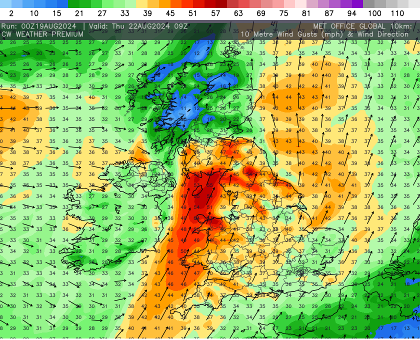
While Ernesto’s winds will have decreased significantly by the time it reaches the UK, gusty conditions are still expected. Coastal areas, particularly in the west, could see winds reaching speeds of 40-60 mph, with possible disruptions to transport and infrastructure.
The Met Office has issued weather warnings for strong winds, advising caution for those traveling or involved in outdoor activities. Winds may also bring down tree branches, create power outages, and cause some localized damage.
4. Temperature Changes
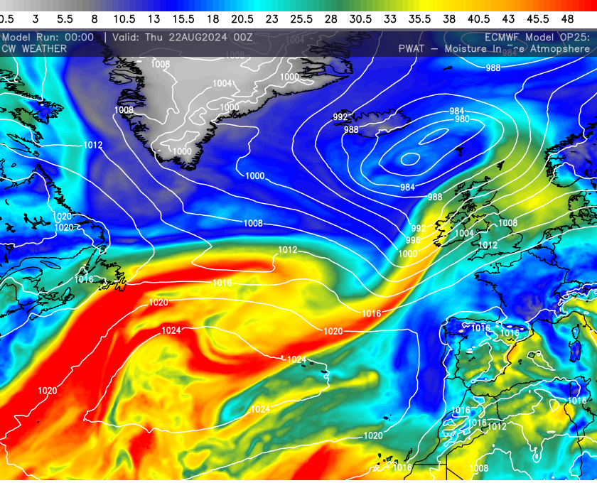
Ernesto’s arrival will coincide with an influx of warm, moist air from the tropics. This could lead to unseasonably warm temperatures, particularly in southern and central parts of the UK. Temperatures are expected to rise above the average for late summer, with some areas possibly seeing highs in the mid-20s Celsius (around 77°F).

However, this warmth will be short-lived, as the storm system will quickly pass, leaving behind cooler, more typical autumn-like weather in its wake.

We first warned of this system last Tuesday via our premium outlays. For more information about our premium side of things head here → CW Weather Premium.
The images and data used is this post are generated “in house” using data from across the globe which then runs through our software to produce the graphics. These are free to view and use but please credit CW Weather. The data page is still in BETA mode but you head here → CW Data Portal and have some fun with the charts, radars and much more.