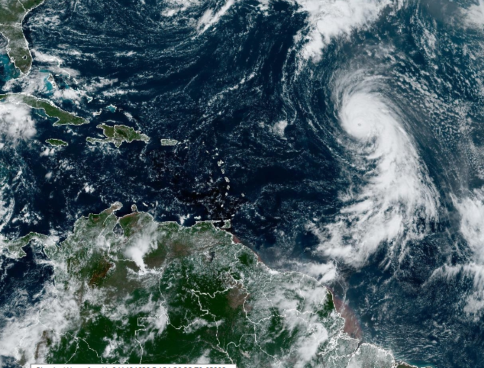
As Hurricane Kirk churns across the Atlantic, it is poised to transition into an extra-tropical storm, which could bring significant weather impacts to the UK. Currently located between the Cape Verde Islands and the Lesser Antilles, Kirk is forecast to strengthen mid-Atlantic before heading northward. By the time it reaches closer to the UK, it is expected to have lost its tropical characteristics but could still cause unsettled weather.
How Ex-Hurricane Kirk Could Affect the UK
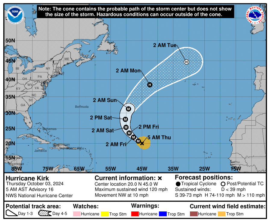
According to the latest weather models, Kirk is likely to become a strong low-pressure system as it moves into cooler waters, losing its hurricane status but retaining some intensity. By the middle of next week, Kirk is forecast to approach the UK, specifically targeting the southwestern regions. While it won’t bring hurricane-force winds, the storm could bring bouts of heavy rain, strong winds, and possibly flooding to parts of the UK.
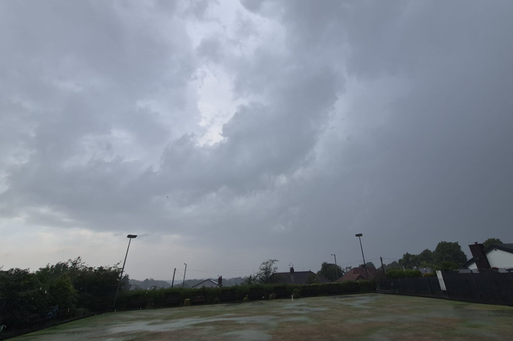
The timing of this event comes on the heels of an already wet late September, when southern parts of the UK saw substantial rainfall. This leaves the ground saturated in many regions, increasing the risk of localised flooding, especially if Kirk delivers additional rain. The storm could bring strong winds, which may cause disruptions to transport and power lines, especially in coastal areas.
What is an Extra-Tropical Storm?
When a hurricane moves north into cooler waters, it typically weakens and undergoes a process called extra-tropical transition. This means the storm loses its tropical characteristics but remains a potent weather system. Extra-tropical storms are often associated with strong wind gusts, heavy rain, and blustery conditions, which can still have significant impacts on local weather.
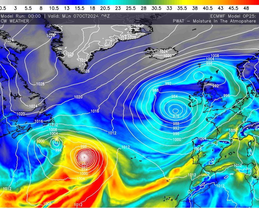
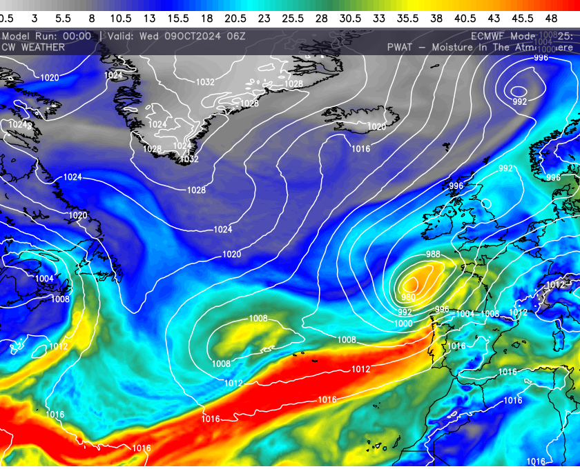
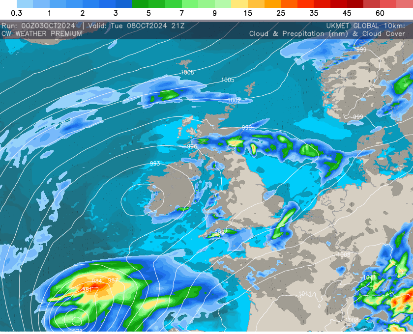
This transition is expected to happen with Kirk as it approaches the UK. The process involves the storm merging with other weather systems, often forming a more traditional mid-latitude cyclone. Yet it wont be the same as traditional systems with a lot more moisture being dragged up with this system and as such more rainfall is likely than would normally be the case. This tropical pull is modelled well by the ECMWF.
Potential Scenarios
Various weather models, including the ECMWF, ECMWF AI CMC/GEM and the GFS, are projecting Kirk’s track to bend eastward across the Atlantic. There is still some uncertainty regarding the exact path and strength, but both models suggest that ex-Hurricane Kirk will bring a wet and windy spell of weather to the UK next week. While major hurricane-force winds are not anticipated, the storm could still pack a punch as an autumn low-pressure system.
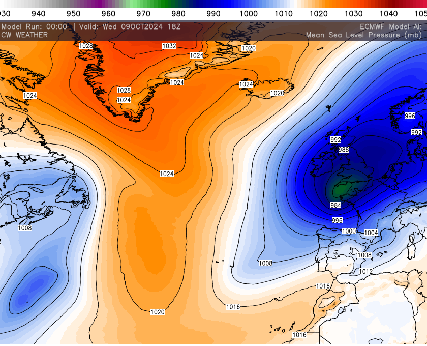
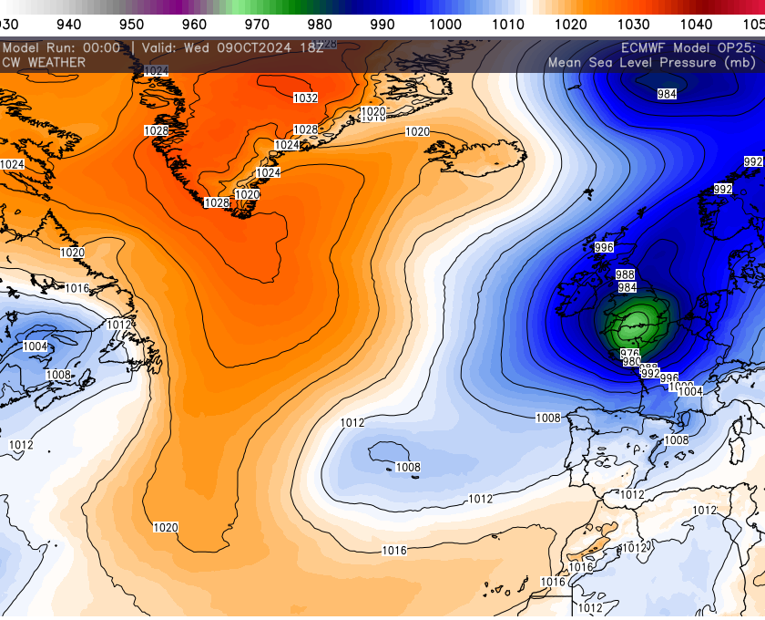
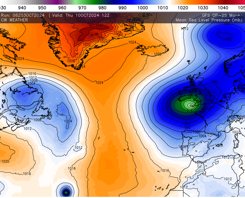
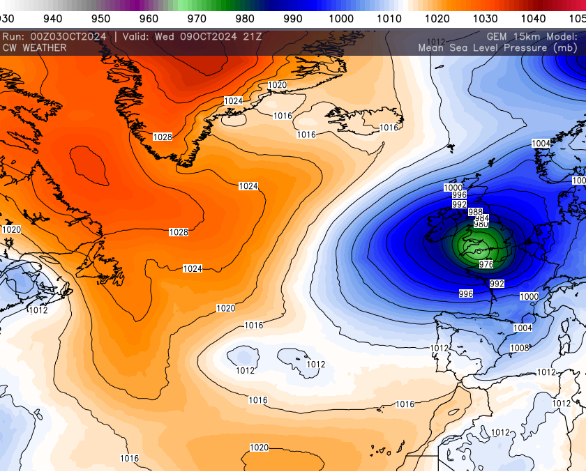
The UKMET Global model has this system in or around the Bay of Biscay late next Tuesday. Any further deepening of the system will largely depend if the Atlantic Jet picks this system up prior to landfall.
So still much to be resolved in terms of strength and overall track but the curve back will occur and this system or remnant’s or extra tropical cyclone will get close to our shores. Make sure you stay tuned for updates.