As we head into the weekend, the UK’s weather will be largely dominated by a high-pressure system, bringing calm and settled conditions for most of the country. However, as the weekend draws to a close, the atmosphere may become more unstable, with the potential for thundery downpours late Sunday into Monday across southern parts of the UK.
High pressure gradually settles across the UK through Friday and then drifts across to Scandinavia through the weekend. While this brings settled weather for most, a switch to easterly winds means some eastern parts may see mist and gloom in the mornings. Western parts certainly seeing the better weather overall, especially where you are sheltered from the east.
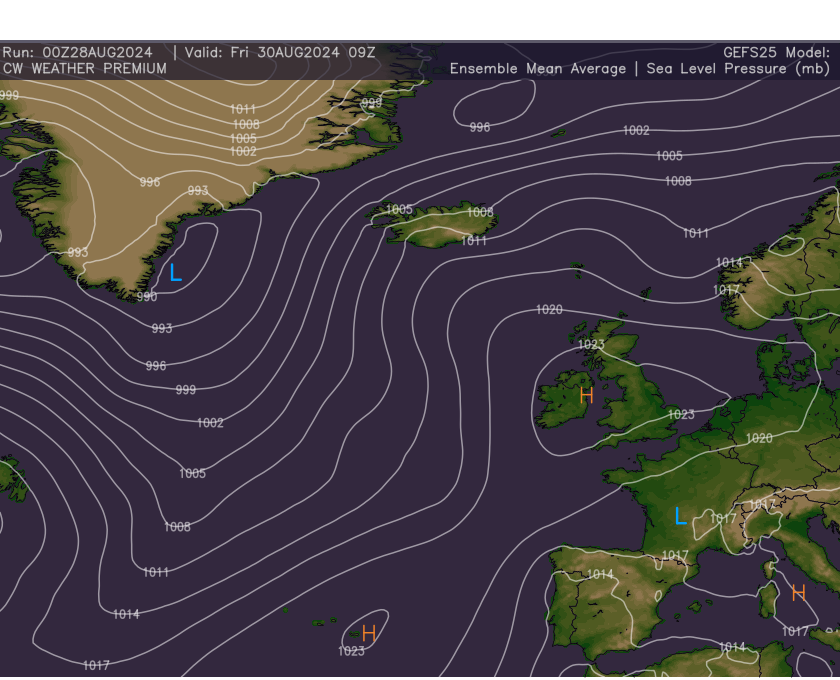
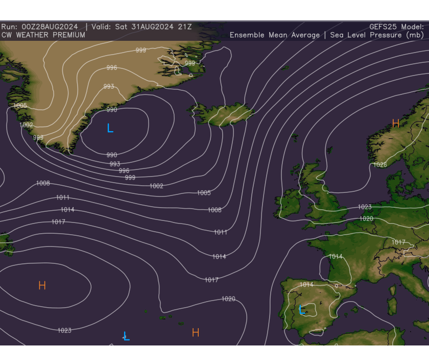
As we shift out of the weekend though there will be a risk of thunder downpours across parts of the south. The UKMET Global model shows this risk well, with a slack surface low just nudging into the south as the high shifts that little further towards Scandinavia.
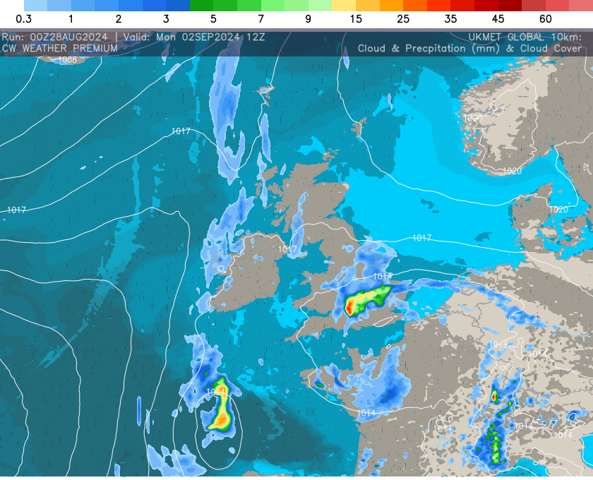
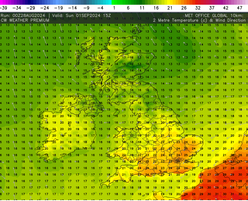
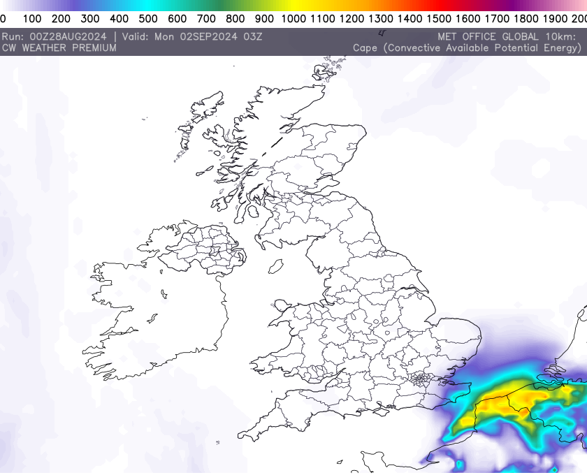
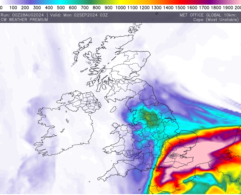
Predicating exactly where these downpours will develop is a tricky process at such range but the instability data shows the risk coming across the South East towards central southern parts. The surface based cape data vs the most unstable cape data suggests the downpours will be elevated in nature and probably not home grown, instead most likely imports from France and Belgium. This certainly the case overnight Sunday.
Temperatures across the weekend will broadly range between 17c to 21c, especially on Friday and Saturday but as the instability increases as will the temperatures, with 20c to 26c possible across the south on Sunday with the rest of the UK remaining broadly similar but perhaps up a couple of degrees overall.