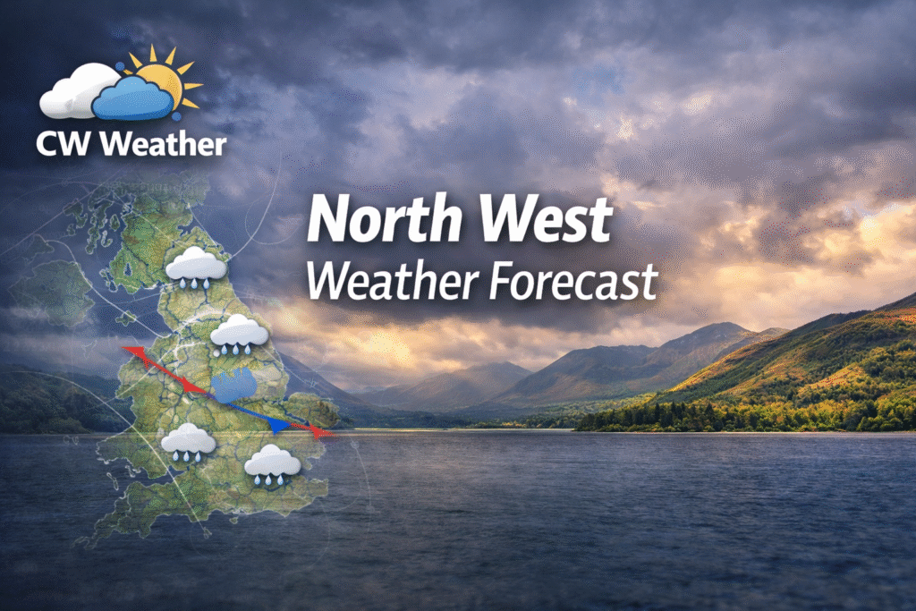
As we head out of what has been a rather mild December (provisionally 2.5c above average) and head into the new year, the weather looks set to take a turn to much colder weather, thanks largely to teleconnections in the tropics. Below i will go into these variables and hopefully give you an idea why this change is set to occur.
What is La Niña Modoki?
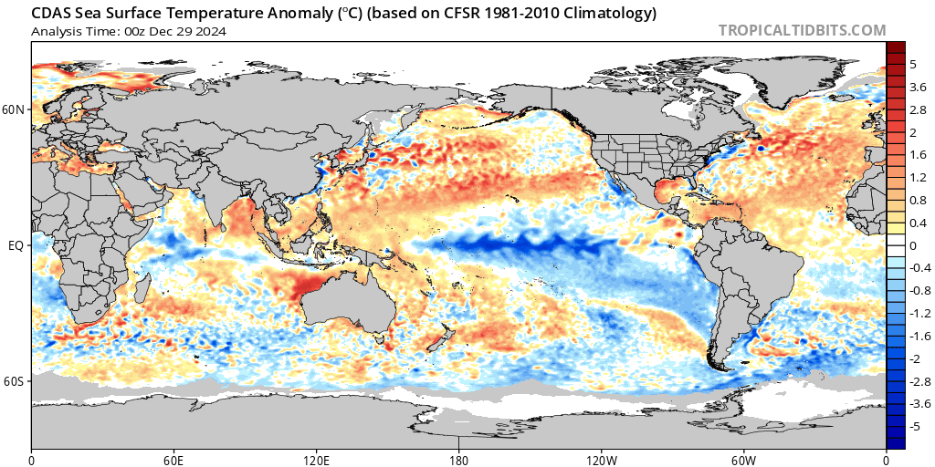
La Niña Modoki (or “pseudo-La Niña”) is a variant of the traditional La Niña event. While a standard La Niña is characterised by cooler-than-average sea surface temperatures (SSTs) in the central and eastern Pacific Ocean, La Niña Modoki features cooler SSTs in the central Pacific but warmer-than-average SSTs in the eastern and western Pacific. The term “Modoki” means “similar but different” in Japanese.
UK Impacts of La Niña Modoki
The effects of La Niña Modoki on the UK’s weather are less direct compared to traditional La Niña. The influence operates via alterations to global circulation patterns, including the jet stream, North Atlantic Oscillation (NAO), and Arctic Oscillation (AO). These changes affect the UK weather indirectly.
Colder Winters: La Niña Modoki can promote a weakened polar vortex and a negative NAO, leading to increased blocking patterns over Greenland and Scandinavia. This setup can bring colder, snowier winters to the UK, particularly in northern and eastern areas.
Storm Tracks: A southward-shifted jet stream might increase storm activity over southern Europe, reducing the frequency of storms in the UK.
The Madden-Julian Oscillation (MJO)
The Madden-Julian Oscillation (MJO) is a tropical atmospheric phenomenon characterised by eastward-moving pulses of enhanced and suppressed convection, often influencing global weather patterns. Its effects can vary depending on the phase, the background state of the El Niño-Southern Oscillation (ENSO), and regional weather dynamics.
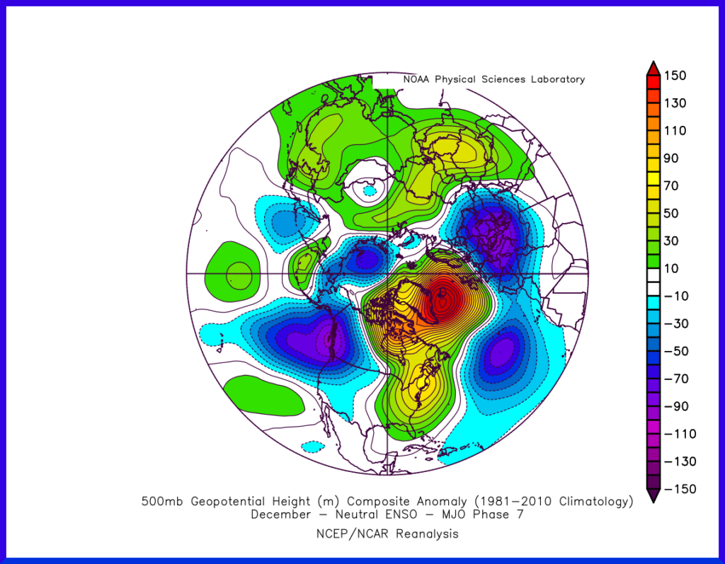
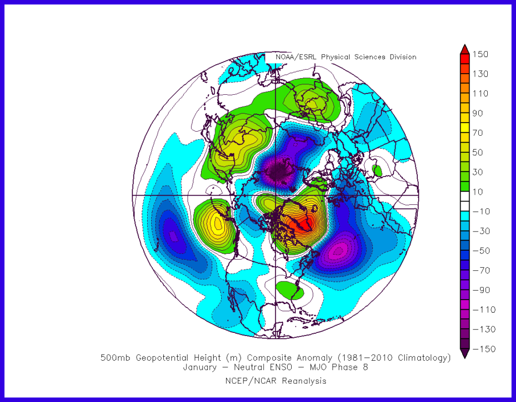
In neutral ENSO conditions, MJO phases 7 and 8 can significantly influence UK weather by altering jet stream dynamics and storm tracks. This increases the risk of cold and blocked patterns. Seasonal timing and interactions with other teleconnections (e.g., the Arctic Oscillation or NAO) play critical roles in determining the specific impacts.
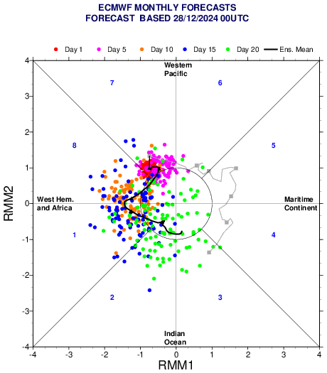
As you can see above, phases 7 and 8 are likely through the next two to three weeks. Historically these phases do indeed favour a blocked pattern in the North Atlantic, below are the patterns that generally develop in these phases.
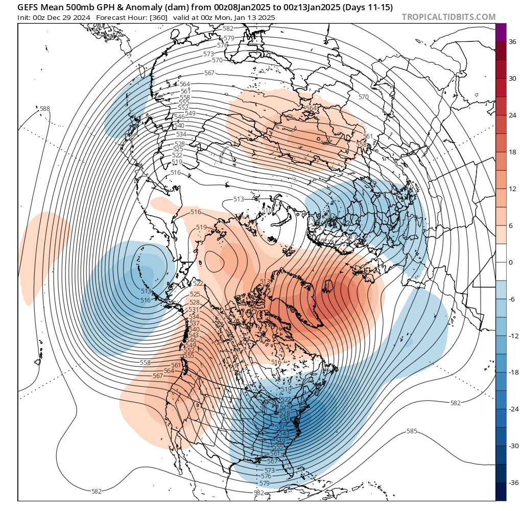
Now if we take a look at the forecast from the GEFS ensemble mean (30 runs of the GFS model with varying starting points) 500mb anomaly we can clearly see a good connection between the forecast and the historical pattern above.
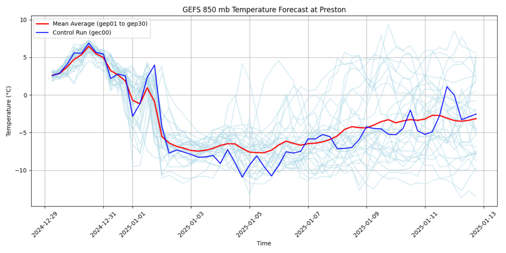
Indeed if we look at the expected air temperature at around 5,000ft, again using the GEFS ensemble we can see clearly using the red mean line, how sharp the temperatures drop as we turn the year, then remain cold for the remainder of the forecast. Yes the red mean line lifts slightly but remains below 0c and we must also remember that part of the forecast is where we hit greater uncertainty.
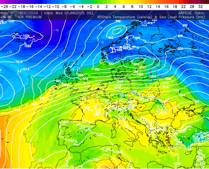
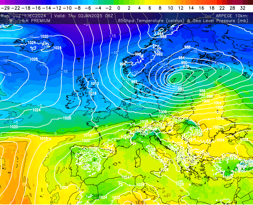
We can see this change occurring even in the shorter range models. The ARPEGE model which is for me one of the best models, shows the colder air filtering down the UK as we turn the year. High pressure building to the west of the UK is in part responsible but as i have already explained there are reasons why this is occurring.
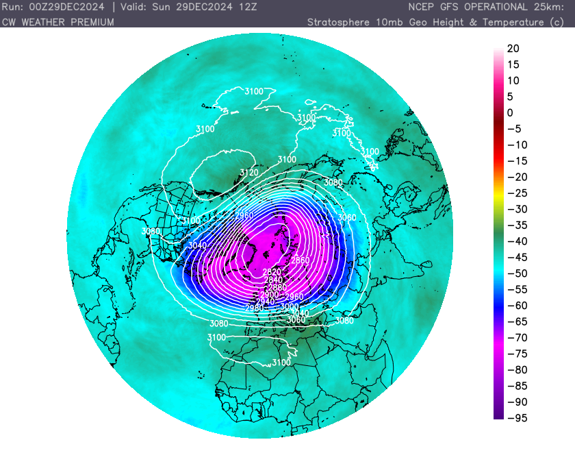
Now on a side note the Polar vortex which often drives our winter weather is incredibly strong at the moment but there is a disconnect between the stratosphere and the troposphere, therefore the strong vortex is having no impact on the weather down below.
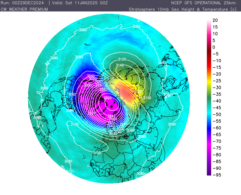
Now the expected blocking that is expected thanks to the MJO may well have impact on the Polar vortex. Instead of the downwelling from the vortex, we could see upwelling from wave breaking (blocking features) in the Troposphere. These can weaken the polar vortex causing splitting events or even sudden stratospheric warmings. The forecast going forward does highlight a warming, weather this transpires into a sudden warming remains to be seen but it will certainly weaken the vortex. This may promote another colder spell further down the line but this does remain a big “if” for now!!
So in summary turning much colder, this will bring impacts across the UK including sleet, snow, frosts and ice. Its impossible to say where the snow will impact at the moment but Scotland certainly seeing plenty in the coming days. Temperatures will often drop below 0c some in the north seeing double digit minus values, so its time to stock up on the firewood and get the winter woollies at the ready!!!